Explore the unfiltered beauty of Taiwan. Click on any card to reveal details and map locations.
Coastal wonders, hidden waterfalls, and urban secrets.
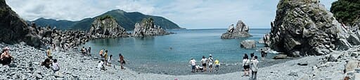
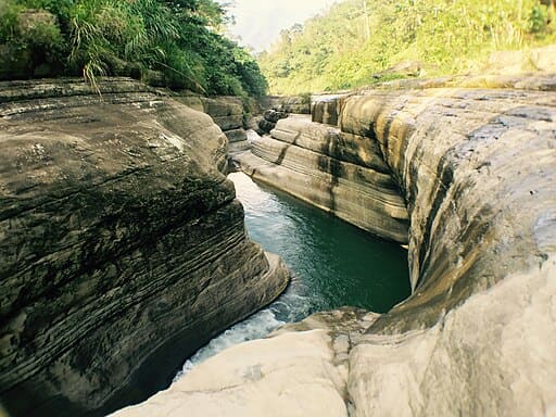
A hidden pebble beach nestled in a fishing harbor, known for its unique rock formations rising from the turquoise sea, resembling a mini Halong Bay.
Google Map ↗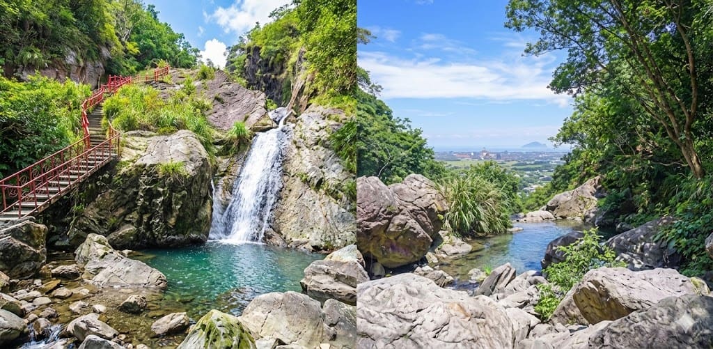
A two-tiered waterfall with a crystal-clear pool at the top. It offers a stunning infinity pool-like view overlooking the Lanyang Plain.
Google Map ↗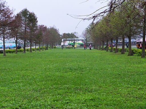
A picturesque riverside park lined with bald cypress trees. In autumn and winter, the leaves turn vibrant red, creating a romantic European-style landscape.
Google Map ↗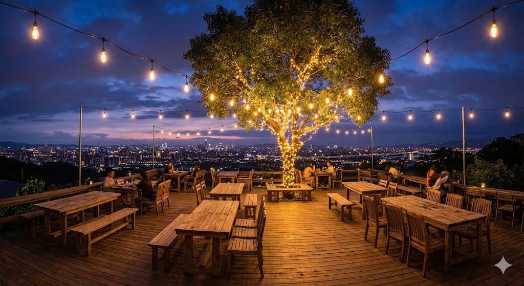
A popular night view cafe located on a hill in Jiaoxi. It offers a spectacular 180-degree panoramic view of the sparkling city lights below.
Google Map ↗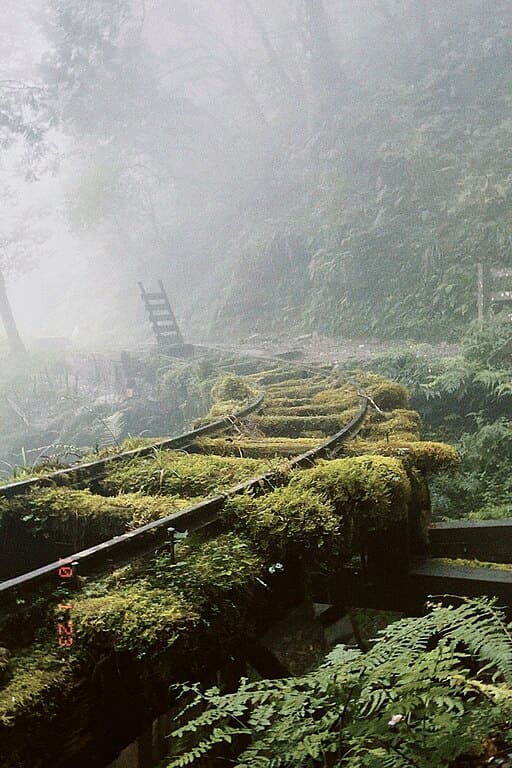
Selected as one of the 28 most beautiful paths in the world. This misty trail features moss-covered old railway tracks from the logging era.
Google Map ↗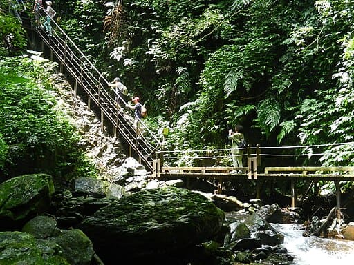
Known as 'Yilan's Little Taroko'. This gentle loop trail follows a stream through a lush subtropical forest with waterfalls and gorges.
Google Map ↗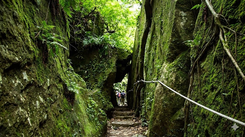
A quiet hiking spot featuring the 'One Line Sky' narrow gorge, ancient stone steps, and a giant rock resembling a golden turtle.
Google Map ↗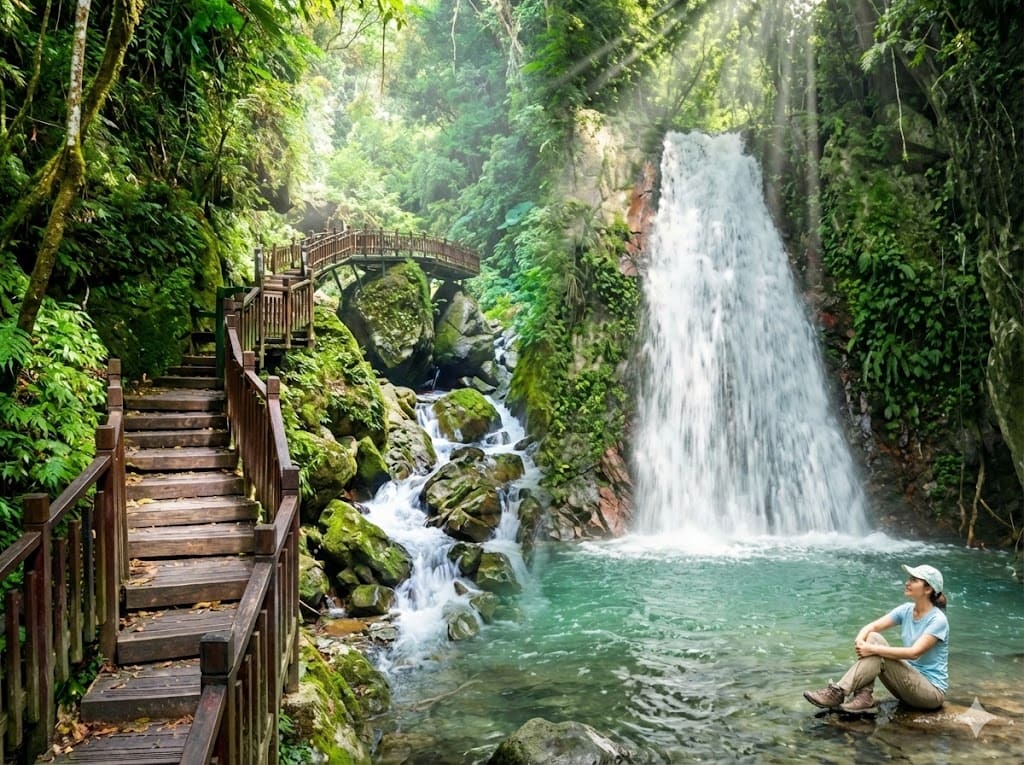
A pristine trail leading to the majestic Laoying (Eagle) Waterfall. The path is built along natural rock walls above the clear stream.
Google Map ↗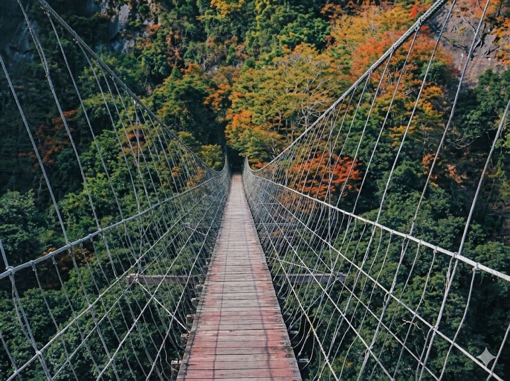
A historic trail famous for its maple leaves in autumn. It connects Hsinchu and Miaoli, featuring remnants of old police stations and suspension bridges.
Google Map ↗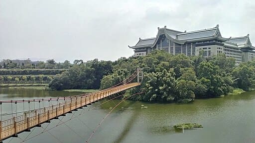
A serene lake surrounded by lush greenery and a massive bronze Maitreya Buddha statue. The suspension bridge offers a peaceful walk over the water.
Google Map ↗
A revitalized scenic spot perfect for cycling and SUP (Stand Up Paddleboarding). The Chinese-style bridge connecting to the small island is iconic.
Google Map ↗
A 250-meter long heart-shaped boardwalk extending into the wetlands. It is the best place to observe thousands of fiddler crabs and watch the sunset.
Google Map ↗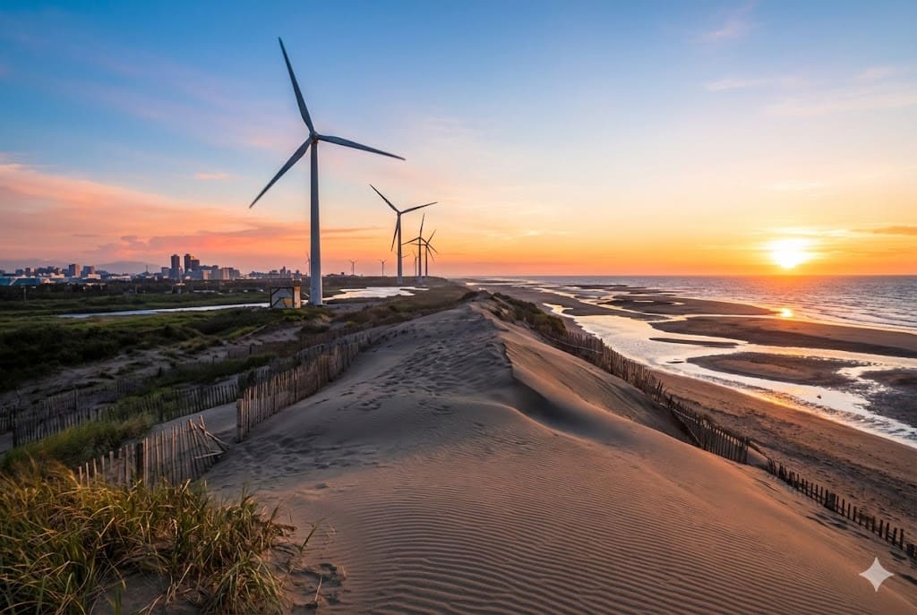
Often called the 'Sahara of Taiwan'. This extensive stretch of coastal sand dunes offers a desolate, desert-like landscape against the backdrop of wind turbines.
Google Map ↗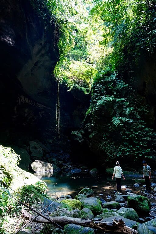
A massive natural rock cave with a semi-circular opening. A waterfall cascades in front of the cave entrance, creating a secluded, mystical atmosphere.
Google Map ↗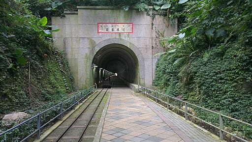
An abandoned railway tunnel transformed into a pedestrian path. It retains its historical charm and provides a cool, shaded walk in summer.
Google Map ↗
Located in Fuxing District, this waterfall is easily accessible via a short wooden boardwalk. The viewing platform puts you right in front of the cascading water.
Google Map ↗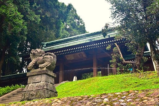
One of the most complete Shinto shrines outside of Japan. Now a cultural park, it hosts weekend markets and offers a serene Japanese atmosphere.
Google Map ↗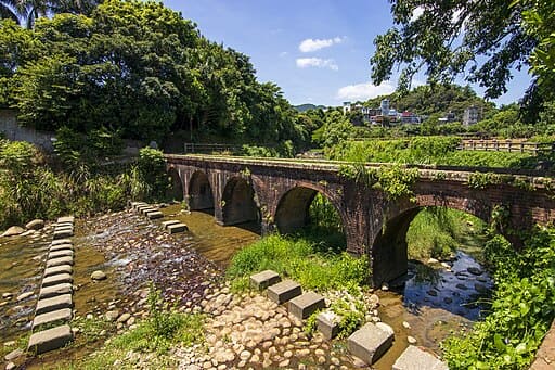
A century-old red brick bridge built during the Japanese era. It crosses the Dah-Han Creek and is a nostalgic spot for picnics and photography.
Google Map ↗
Meaning 'Valley of Forgetting Worries'. A V-shaped valley with green grass and ocean views. The trail leads to a high point overlooking Keelung Islet.
Google Map ↗
A short and easy trail near the NMMST museum. The circular observation deck at the top offers a 360-degree view of Badouzi and the coast.
Google Map ↗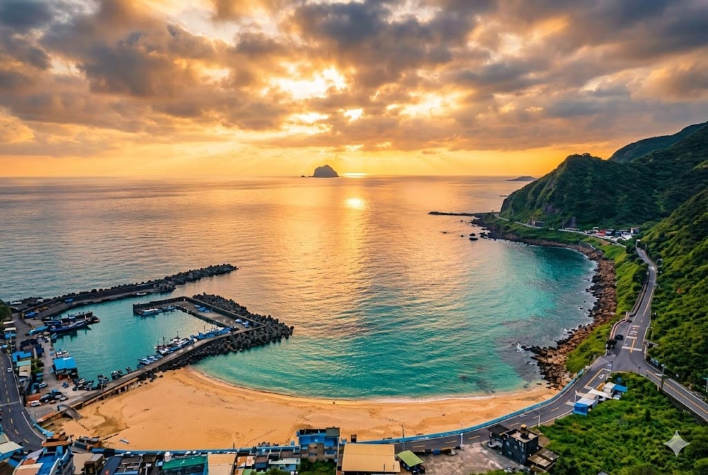
Keelung's only sandy beach. It features golden sand and clear water, making it a popular spot for swimming and watching the sunrise.
Google Map ↗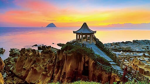
Famous for its unique eroded rock formations like the 'Tofu Rocks'. It also features a natural seawater swimming pool connected to the ocean.
Google Map ↗
An old automotive parts street transformed into a hipster hub. Filled with vintage shops, independent cafes, and street art, blending old and new Taipei.
Google Map ↗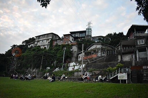
A historical hillside settlement turned into an art village. Its winding alleys, art installations, and river views make it a unique urban exploration spot.
Google Map ↗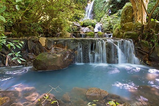
Located in Yangmingshan, this milky-white sulfur waterfall is a hidden gem often overlooked by tourists visiting the Flower Clock.
Google Map ↗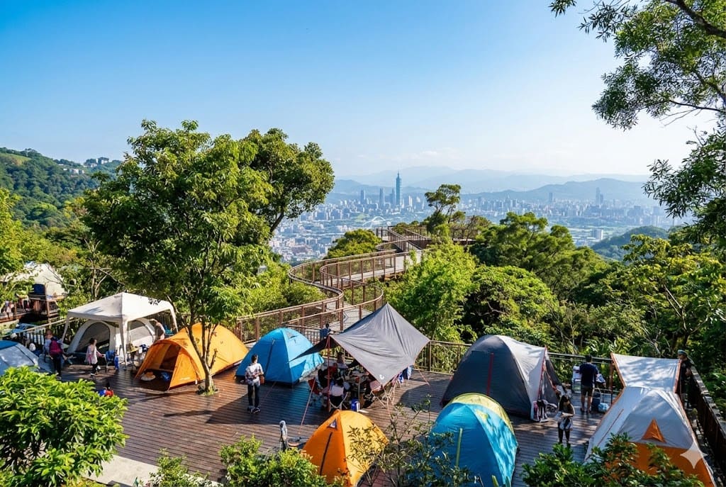
A campsite in Neihu that offers a stunning night view of Taipei 101. The skywalk here is a great spot for evening strolls.
Google Map ↗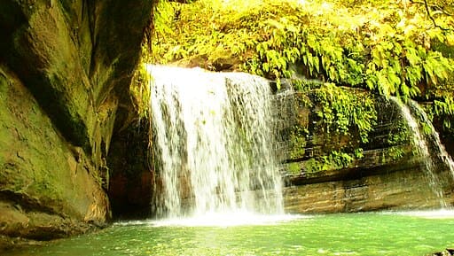
A secluded waterfall near the Pingxi Line railway. It is less crowded than Shifen Waterfall and offers a serene, mystical atmosphere.
Google Map ↗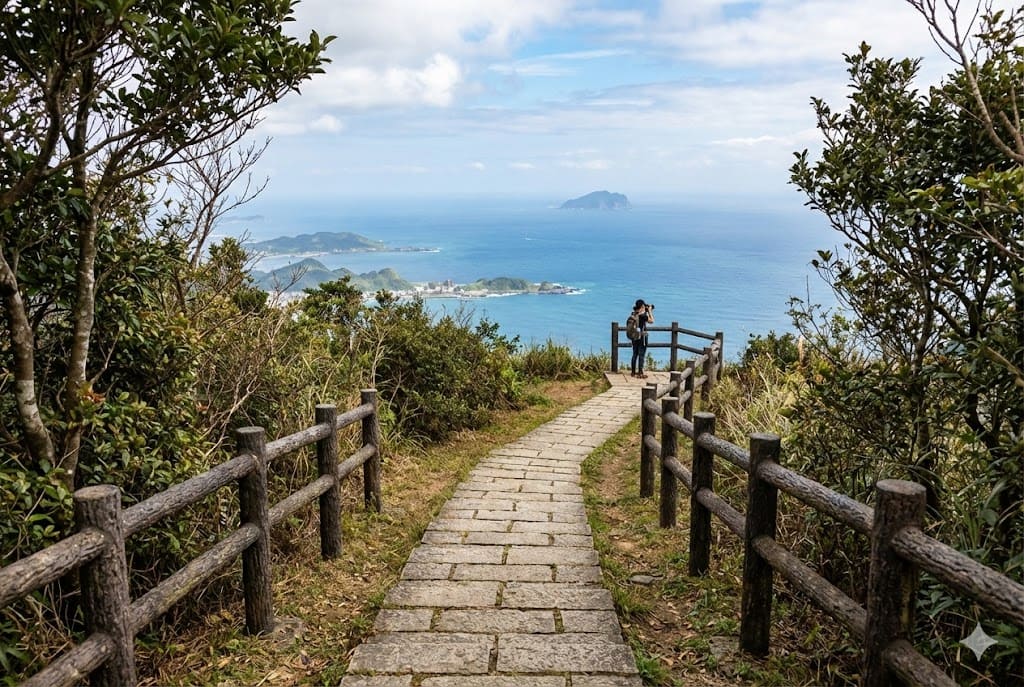
An ancient trail in Ruifang dating back to the gold mining era. It offers expansive views of Keelung Mountain and the sea of clouds.
Google Map ↗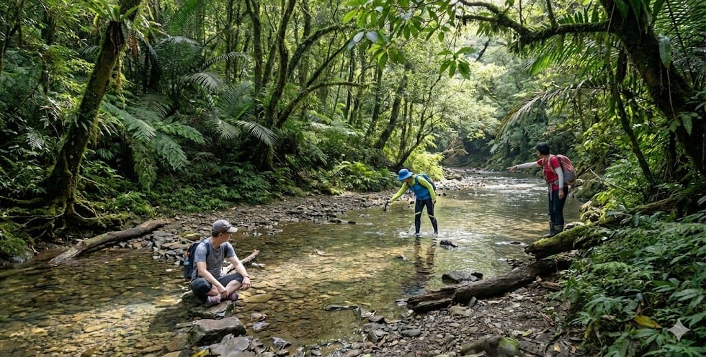
A gentle, shaded trail that follows a stream. The lush green forest canopy makes it feel like walking in a natural green tunnel.
Google Map ↗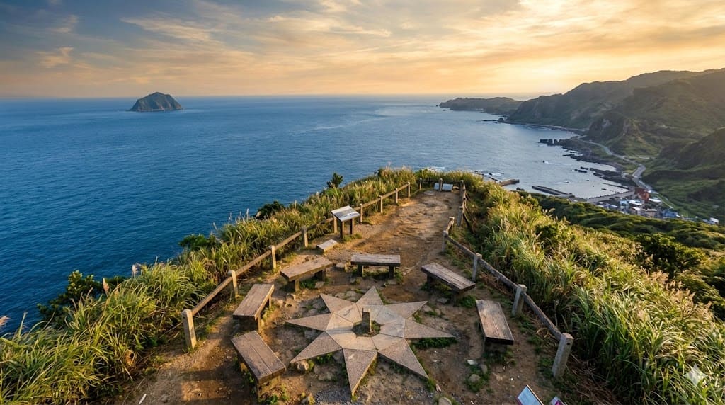
A short hike that rewards you with 360-degree views of the Northeast Coast, including the Nanya Rock Formations and the winding coastal highway.
Google Map ↗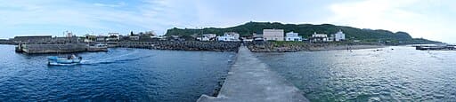
The easternmost fishing village in Taiwan. Known for its traditional stone houses, intertidal zone ecology, and laid-back cat population.
Google Map ↗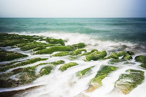
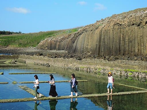
A seasonal wonder (Mar-May) where volcanic rock troughs are covered in vibrant green algae, creating a unique coastal landscape.
Google Map ↗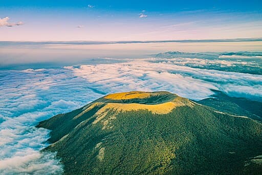
An ecological protected area in Yangmingshan (permit required). It features a perfectly preserved volcanic crater and a pristine mountain lake.
Google Map ↗
A hidden pebble beach nestled in a fishing harbor, known for its unique rock formations rising from the turquoise sea, resembling a mini Halong Bay.
Google Map ↗
A two-tiered waterfall with a crystal-clear pool at the top. It offers a stunning infinity pool-like view overlooking the Lanyang Plain.
Google Map ↗
A picturesque riverside park lined with bald cypress trees. In autumn and winter, the leaves turn vibrant red, creating a romantic European-style landscape.
Google Map ↗
A popular night view cafe located on a hill in Jiaoxi. It offers a spectacular 180-degree panoramic view of the sparkling city lights below.
Google Map ↗
Selected as one of the 28 most beautiful paths in the world. This misty trail features moss-covered old railway tracks from the logging era.
Google Map ↗
Known as 'Yilan's Little Taroko'. This gentle loop trail follows a stream through a lush subtropical forest with waterfalls and gorges.
Google Map ↗
A quiet hiking spot featuring the 'One Line Sky' narrow gorge, ancient stone steps, and a giant rock resembling a golden turtle.
Google Map ↗
A pristine trail leading to the majestic Laoying (Eagle) Waterfall. The path is built along natural rock walls above the clear stream.
Google Map ↗
A historic trail famous for its maple leaves in autumn. It connects Hsinchu and Miaoli, featuring remnants of old police stations and suspension bridges.
Google Map ↗
A serene lake surrounded by lush greenery and a massive bronze Maitreya Buddha statue. The suspension bridge offers a peaceful walk over the water.
Google Map ↗
A revitalized scenic spot perfect for cycling and SUP (Stand Up Paddleboarding). The Chinese-style bridge connecting to the small island is iconic.
Google Map ↗
A 250-meter long heart-shaped boardwalk extending into the wetlands. It is the best place to observe thousands of fiddler crabs and watch the sunset.
Google Map ↗
Often called the 'Sahara of Taiwan'. This extensive stretch of coastal sand dunes offers a desolate, desert-like landscape against the backdrop of wind turbines.
Google Map ↗
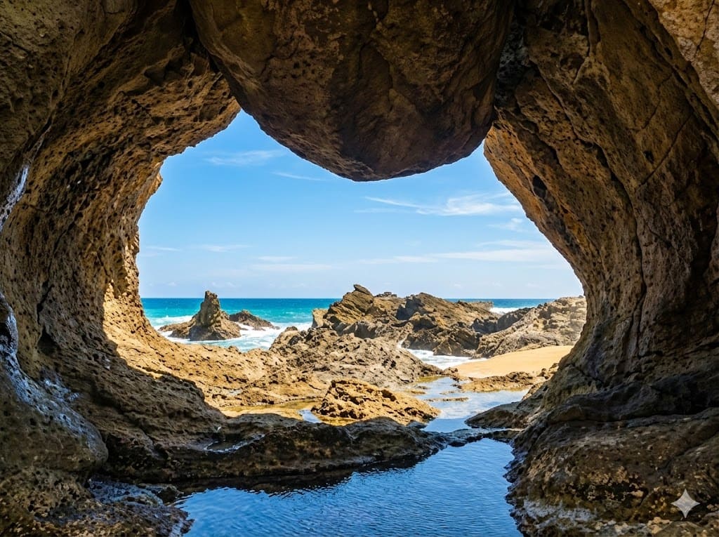
A massive natural rock cave with a semi-circular opening. A waterfall cascades in front of the cave entrance, creating a secluded, mystical atmosphere.
Google Map ↗
An abandoned railway tunnel transformed into a pedestrian path. It retains its historical charm and provides a cool, shaded walk in summer.
Google Map ↗
Located in Fuxing District, this waterfall is easily accessible via a short wooden boardwalk. The viewing platform puts you right in front of the cascading water.
Google Map ↗
One of the most complete Shinto shrines outside of Japan. Now a cultural park, it hosts weekend markets and offers a serene Japanese atmosphere.
Google Map ↗
A century-old red brick bridge built during the Japanese era. It crosses the Dah-Han Creek and is a nostalgic spot for picnics and photography.
Google Map ↗
Meaning 'Valley of Forgetting Worries'. A V-shaped valley with green grass and ocean views. The trail leads to a high point overlooking Keelung Islet.
Google Map ↗
A short and easy trail near the NMMST museum. The circular observation deck at the top offers a 360-degree view of Badouzi and the coast.
Google Map ↗
Keelung's only sandy beach. It features golden sand and clear water, making it a popular spot for swimming and watching the sunrise.
Google Map ↗
Famous for its unique eroded rock formations like the 'Tofu Rocks'. It also features a natural seawater swimming pool connected to the ocean.
Google Map ↗
An old automotive parts street transformed into a hipster hub. Filled with vintage shops, independent cafes, and street art, blending old and new Taipei.
Google Map ↗
A historical hillside settlement turned into an art village. Its winding alleys, art installations, and river views make it a unique urban exploration spot.
Google Map ↗
Located in Yangmingshan, this milky-white sulfur waterfall is a hidden gem often overlooked by tourists visiting the Flower Clock.
Google Map ↗
A campsite in Neihu that offers a stunning night view of Taipei 101. The skywalk here is a great spot for evening strolls.
Google Map ↗
A secluded waterfall near the Pingxi Line railway. It is less crowded than Shifen Waterfall and offers a serene, mystical atmosphere.
Google Map ↗
An ancient trail in Ruifang dating back to the gold mining era. It offers expansive views of Keelung Mountain and the sea of clouds.
Google Map ↗
A gentle, shaded trail that follows a stream. The lush green forest canopy makes it feel like walking in a natural green tunnel.
Google Map ↗
A short hike that rewards you with 360-degree views of the Northeast Coast, including the Nanya Rock Formations and the winding coastal highway.
Google Map ↗
The easternmost fishing village in Taiwan. Known for its traditional stone houses, intertidal zone ecology, and laid-back cat population.
Google Map ↗
A seasonal wonder (Mar-May) where volcanic rock troughs are covered in vibrant green algae, creating a unique coastal landscape.
Google Map ↗
An ecological protected area in Yangmingshan (permit required). It features a perfectly preserved volcanic crater and a pristine mountain lake.
Google Map ↗Rolling hills, cultural heritage, and breathtaking mountain lakes.
A magnificent V-shaped canyon formed by the Qingshui River cutting through rock. The rock layers reveal vibrant colors and textures.
Google Map ↗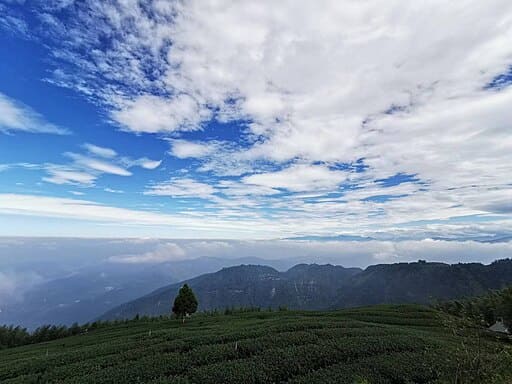
Located at the junction of three counties, it offers a 360-degree panoramic view of tea plantations and seas of clouds.
Google Map ↗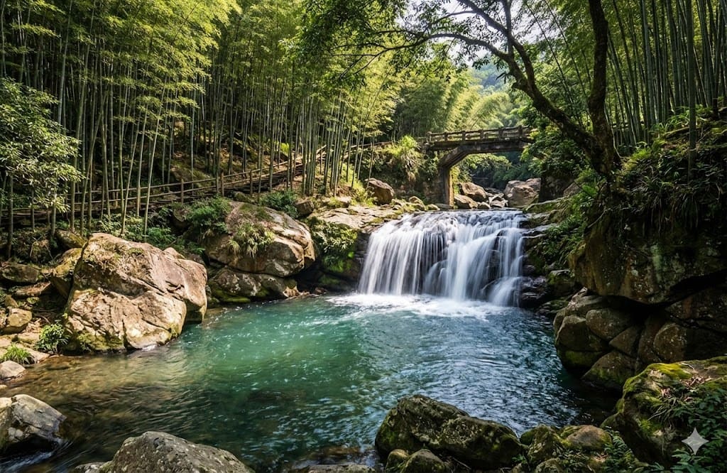
A spectacular riverbed composed of a single massive rock slab. The potholes and flowing water create a fairyland-like atmosphere.
Google Map ↗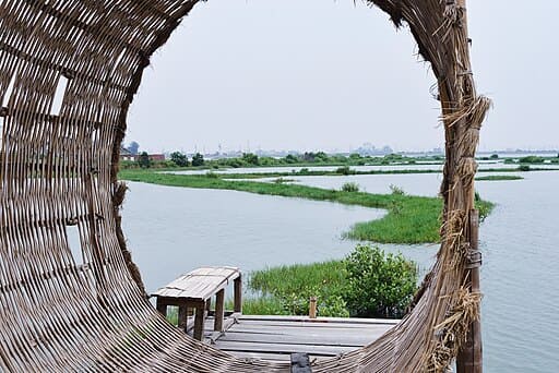
Originally farmland reclaimed by the sea, it is now an ecological paradise for migratory birds and features unique environmental art installations.
Google Map ↗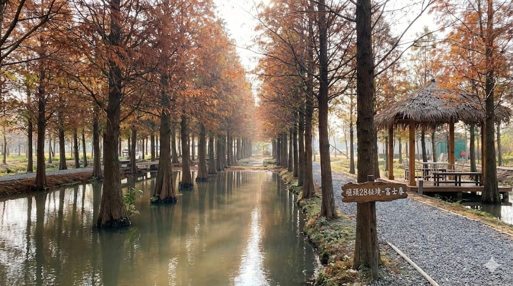
A hidden bald cypress forest that turns a stunning rusty red in autumn and winter, creating a romantic, picture-perfect scenery.
Google Map ↗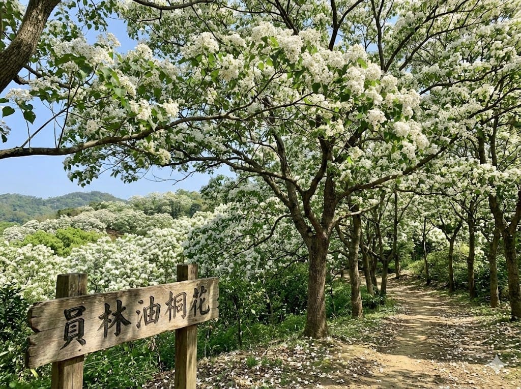
In late spring, the Tung flowers bloom like "May snow," covering the hiking trails in a beautiful white carpet.
Google Map ↗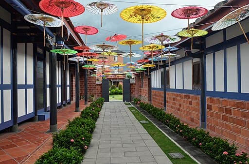
Known as the "Kenrokuen of Taiwan," this exquisite garden features century-old trees, traditional Hakka architecture, and meticulous landscaping.
Google Map ↗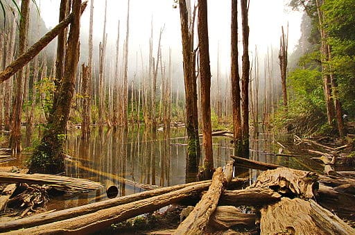
A misty swamp forest formed after the 921 earthquake. The withered cedar trees standing in the water create a surreal, dreamlike reflection.
Google Map ↗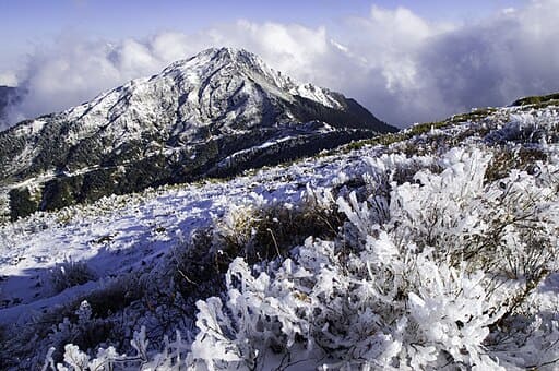
Taiwan's first International Dark Sky Park. It offers world-class stargazing conditions with minimal light pollution and breathtaking high-mountain views.
Google Map ↗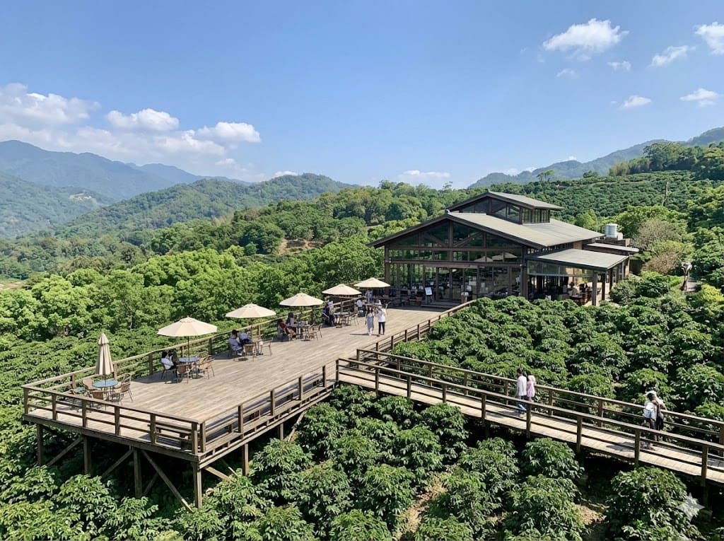
A scenic coffee estate surrounded by tea fields. The observation deck offers a stunning view of the lush green mountains while you enjoy local coffee.
Google Map ↗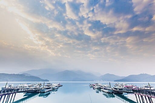
One of the best spots to watch the sunrise at Sun Moon Lake. The morning mist over the water creates a poetic, ink-painting-like scene.
Google Map ↗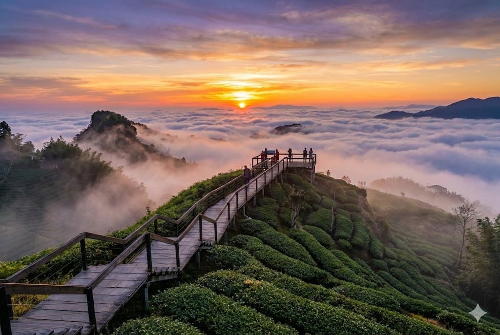
Famous for its ginkgo forest and oolong tea plantations. In autumn, the golden ginkgo leaves contrast beautifully with the green tea bushes.
Google Map ↗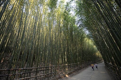
Often compared to Arashiyama in Kyoto, this tunnel of towering bamboo provides a serene and photogenic escape into nature.
Google Map ↗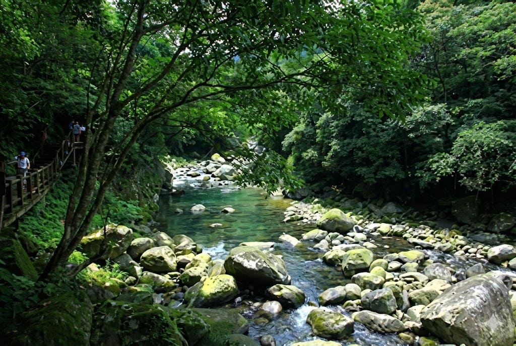
A successful ecological restoration site. The crystal-clear water allows you to see schools of fish swimming, surrounded by lush greenery.
Google Map ↗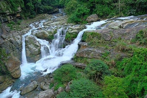
A sacred place for the Atayal tribe and a filming location for *Seediq Bale*. The waterfalls and suspension bridge offer a majestic view of the valley.
Google Map ↗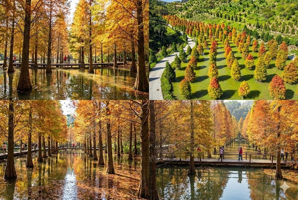
A private estate open to the public where bald cypress trees grow in water. The reflections in the pond create a mesmerizing autumnal landscape.
Google Map ↗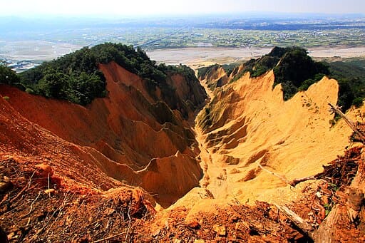
Known as Taiwan's Grand Canyon. The red laterite soil and jagged cliffs create a fiery, dramatic landscape that is distinct from the surrounding green hills.
Google Map ↗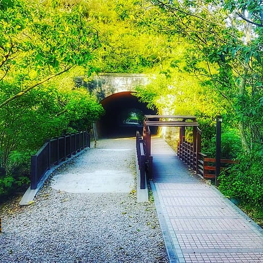
Historic railway tunnels that resemble a scene from *Spirited Away*. The nearby observation deck offers a great view of the coastline and wind turbines.
Google Map ↗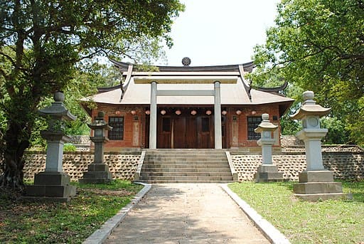
One of the few well-preserved Shinto shrines in Taiwan. The Torii gate and main hall offer a quiet, historical atmosphere overlooking the town.
Google Map ↗
A photography base designed with various themes, including a Japanese street, a white church, and European gardens, perfect for Instagram shots.
Google Map ↗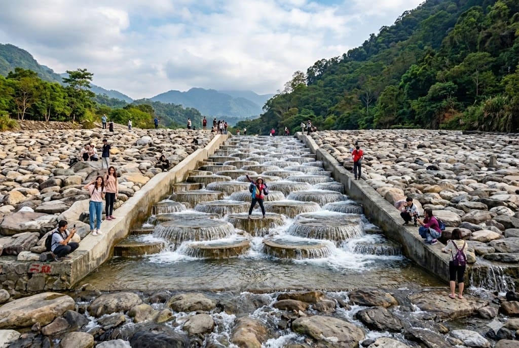
A unique engineering design resembling a "Turkey pattern." It helps fish migrate upstream while creating a geometrically beautiful water landscape.
Google Map ↗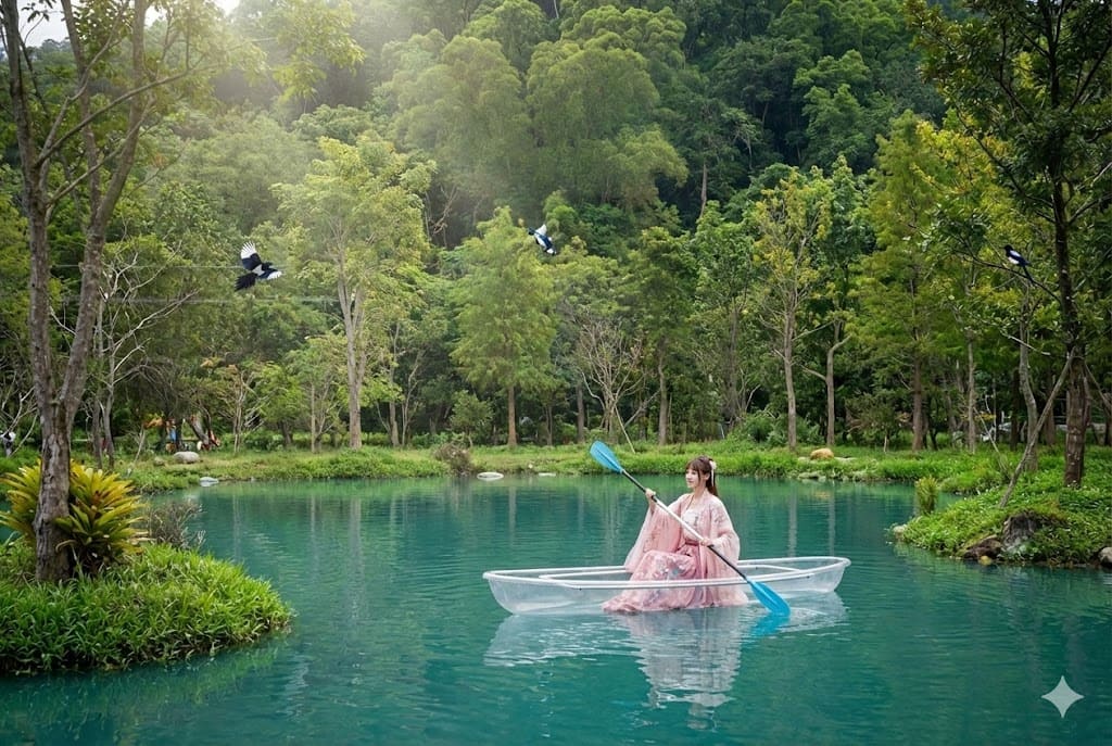
An abandoned structure that has been reclaimed by nature, creating a mysterious and photogenic ruin often visited by urban explorers.
Google Map ↗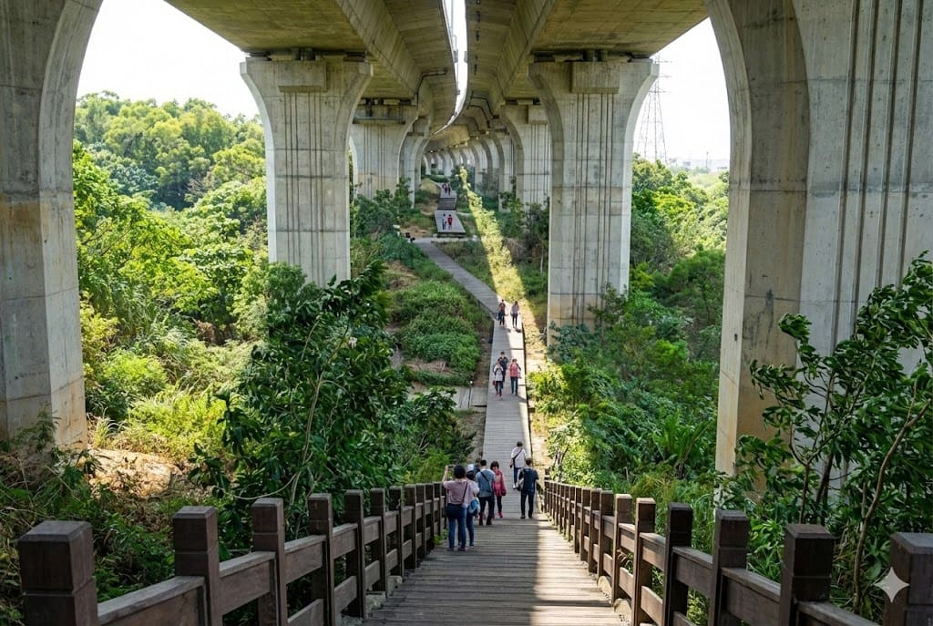
Often called the "Mini Great Wall" of Taichung. This elevated highway-side trail offers a unique perspective of the city and is a hidden spot for photographers.
Google Map ↗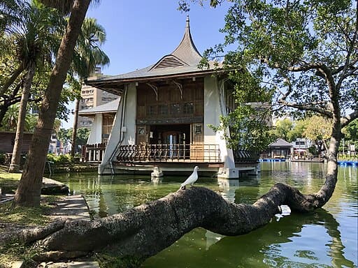
The oldest park in Taichung, featuring the iconic Lake Pavilion built in 1908. A symbol of the city's history and a peaceful urban oasis.
Google Map ↗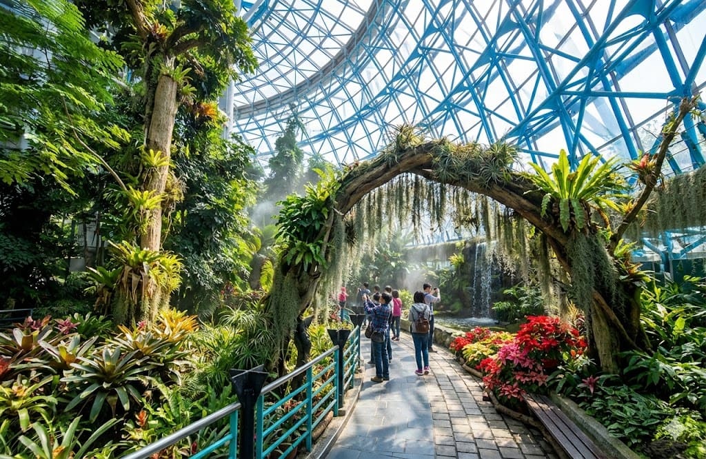
A massive glass greenhouse housing a tropical rainforest at the NMNS. It features a giant artificial waterfall and diverse plant species, making it an educational and visual gem.
Google Map ↗
A magnificent V-shaped canyon formed by the Qingshui River cutting through rock. The rock layers reveal vibrant colors and textures.
Google Map ↗
Located at the junction of three counties, it offers a 360-degree panoramic view of tea plantations and seas of clouds.
Google Map ↗
A spectacular riverbed composed of a single massive rock slab. The potholes and flowing water create a fairyland-like atmosphere.
Google Map ↗
Originally farmland reclaimed by the sea, it is now an ecological paradise for migratory birds and features unique environmental art installations.
Google Map ↗
A hidden bald cypress forest that turns a stunning rusty red in autumn and winter, creating a romantic, picture-perfect scenery.
Google Map ↗
In late spring, the Tung flowers bloom like "May snow," covering the hiking trails in a beautiful white carpet.
Google Map ↗
Known as the "Kenrokuen of Taiwan," this exquisite garden features century-old trees, traditional Hakka architecture, and meticulous landscaping.
Google Map ↗
A misty swamp forest formed after the 921 earthquake. The withered cedar trees standing in the water create a surreal, dreamlike reflection.
Google Map ↗
Taiwan's first International Dark Sky Park. It offers world-class stargazing conditions with minimal light pollution and breathtaking high-mountain views.
Google Map ↗
A scenic coffee estate surrounded by tea fields. The observation deck offers a stunning view of the lush green mountains while you enjoy local coffee.
Google Map ↗
One of the best spots to watch the sunrise at Sun Moon Lake. The morning mist over the water creates a poetic, ink-painting-like scene.
Google Map ↗
Famous for its ginkgo forest and oolong tea plantations. In autumn, the golden ginkgo leaves contrast beautifully with the green tea bushes.
Google Map ↗
Often compared to Arashiyama in Kyoto, this tunnel of towering bamboo provides a serene and photogenic escape into nature.
Google Map ↗
A successful ecological restoration site. The crystal-clear water allows you to see schools of fish swimming, surrounded by lush greenery.
Google Map ↗
A sacred place for the Atayal tribe and a filming location for *Seediq Bale*. The waterfalls and suspension bridge offer a majestic view of the valley.
Google Map ↗
A private estate open to the public where bald cypress trees grow in water. The reflections in the pond create a mesmerizing autumnal landscape.
Google Map ↗
Known as Taiwan's Grand Canyon. The red laterite soil and jagged cliffs create a fiery, dramatic landscape that is distinct from the surrounding green hills.
Google Map ↗
Historic railway tunnels that resemble a scene from *Spirited Away*. The nearby observation deck offers a great view of the coastline and wind turbines.
Google Map ↗
One of the few well-preserved Shinto shrines in Taiwan. The Torii gate and main hall offer a quiet, historical atmosphere overlooking the town.
Google Map ↗
A photography base designed with various themes, including a Japanese street, a white church, and European gardens, perfect for Instagram shots.
Google Map ↗
A unique engineering design resembling a "Turkey pattern." It helps fish migrate upstream while creating a geometrically beautiful water landscape.
Google Map ↗
An abandoned structure that has been reclaimed by nature, creating a mysterious and photogenic ruin often visited by urban explorers.
Google Map ↗
Often called the "Mini Great Wall" of Taichung. This elevated highway-side trail offers a unique perspective of the city and is a hidden spot for photographers.
Google Map ↗
The oldest park in Taichung, featuring the iconic Lake Pavilion built in 1908. A symbol of the city's history and a peaceful urban oasis.
Google Map ↗
A massive glass greenhouse housing a tropical rainforest at the NMNS. It features a giant artificial waterfall and diverse plant species, making it an educational and visual gem.
Google Map ↗Ancient capitals, warm hospitality, and tropical vibes.
An engineering marvel from 1923 hidden in the forest. This underground weir system uses natural gravity to collect crystal-clear water, creating a sustainable water source that flows year-round.
Google Map ↗
A hidden seven-tiered waterfall located in Manzhou Township. The trail involves some rope climbing, leading to refreshing natural pools perfect for escaping the summer heat.
Google Map ↗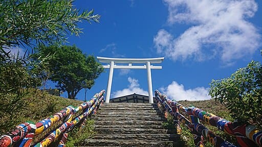
A reconstructed Shinto shrine with a pure white Torii gate standing atop a hill. It offers a breathtaking panoramic view of the mountains meeting the Pacific Ocean.
Google Map ↗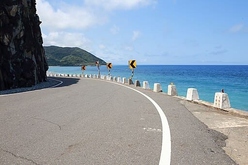
A serene coastline known for its beautiful pebble beaches and the historic Mudan Incident. It's a place where the mountains dramatically meet the sea, perfect for watching the sunrise.
Google Map ↗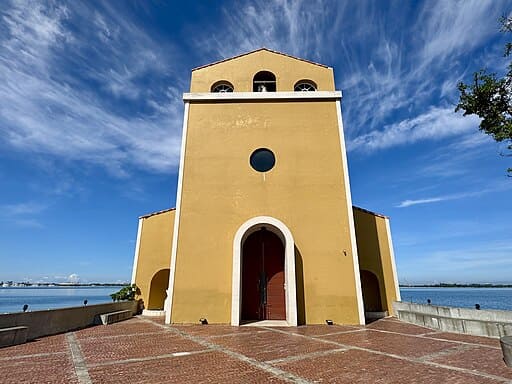
A distinct yellow European-style architecture floating on Dapeng Bay. This cafe offers a romantic atmosphere with high ceilings and 360-degree ocean views.
Google Map ↗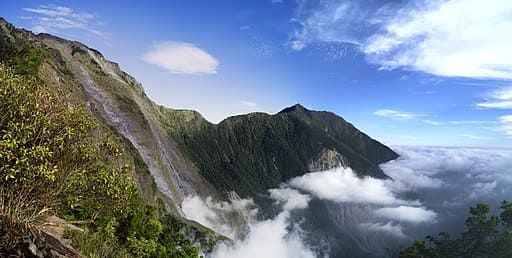
The southernmost of Taiwan's 'Five Great Mountains'. Standing at 3,092 meters, it is famous for its majestic sea of clouds, iron hemlock forests, and stunning sunsets.
Google Map ↗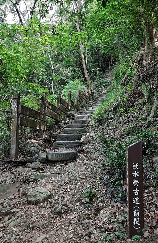
An ancient cross-island trail used since the Qing Dynasty. Rich in biodiversity and history, it connects Pingtung to Taitung through lush forests and misty ridges.
Google Map ↗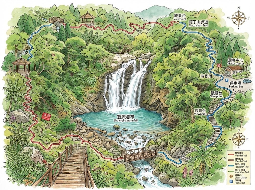
Named after the confluence of two streams, this park features a majestic waterfall, stepping-stone trails across rivers, and a rich ecosystem of butterflies and birds.
Google Map ↗
A challenging hike that rewards you with one of the best views in Southern Taiwan. The summit offers a commanding view of the Hengchun Peninsula and the ocean.
Google Map ↗
An easy-to-access trail near the aquarium (NMMBA). The observation deck provides a stunning view of the river mouth entering the ocean and the coastline.
Google Map ↗
The historic site of the Mudan Incident battlefield. The trail involves steep climbs but offers expansive views of the Mudan Reservoir and the surrounding valley.
Google Map ↗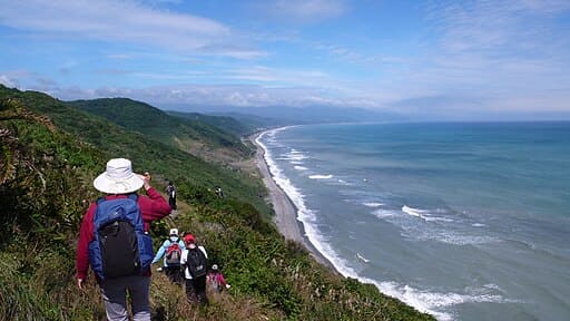
One of Taiwan's last remaining natural coastlines without a highway. The trail features rugged pebble beaches and raw, untouched ocean scenery.
Google Map ↗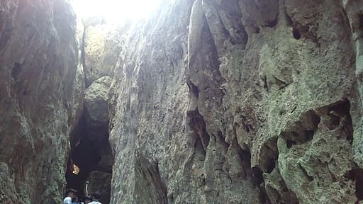
A unique botanical garden built on uplifted coral reefs. Explore limestone caves, massive banyan trees, and the iconic Looking Glass Tree.
Google Map ↗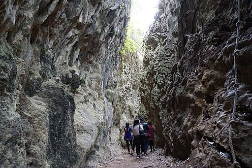
Famous for its limestone terrain and caves. The 'One Line Sky' gorge and the stalactites in the Stone Mother's Milk cave are natural wonders.
Google Map ↗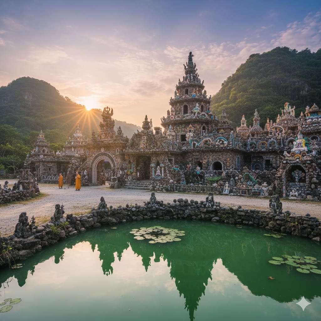
A unique temple built entirely from seashells, coral, and stones by migrant workers. Its intricate design resembles the work of Gaudí.
Google Map ↗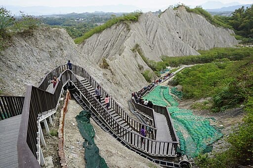
A surreal badlands landscape that resembles the moon's surface. The rugged terrain and desolate beauty make it a photographer's paradise.
Google Map ↗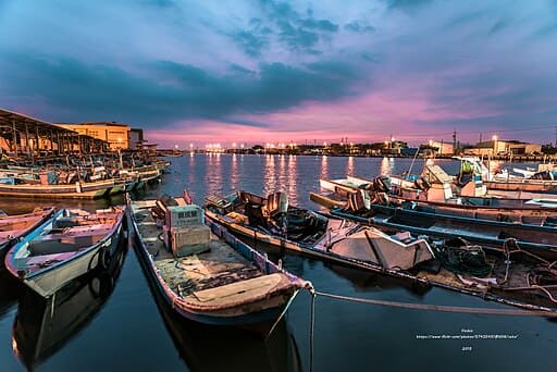
A charming fishing port featuring a boardwalk extending into the sea. It's a perfect spot for a leisurely stroll and watching the sunset.
Google Map ↗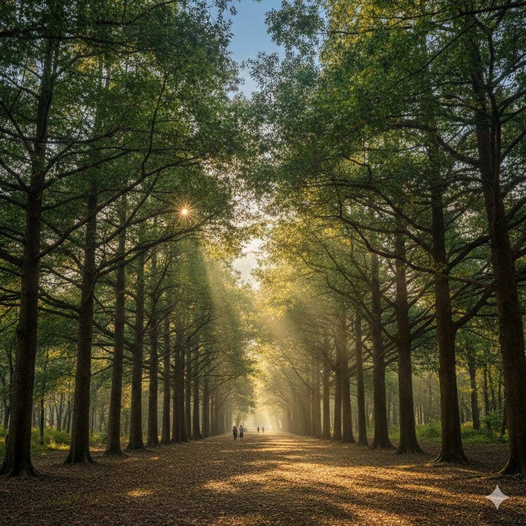
Renowned for its majestic mahogany tree avenue that stretches for kilometers. The falling leaves in spring create a romantic, poetic atmosphere.
Google Map ↗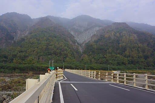
An off-the-beaten-path destination on the historic Aliguan Trail. It offers a glimpse into Taiwan's past and primitive forest landscapes.
Google Map ↗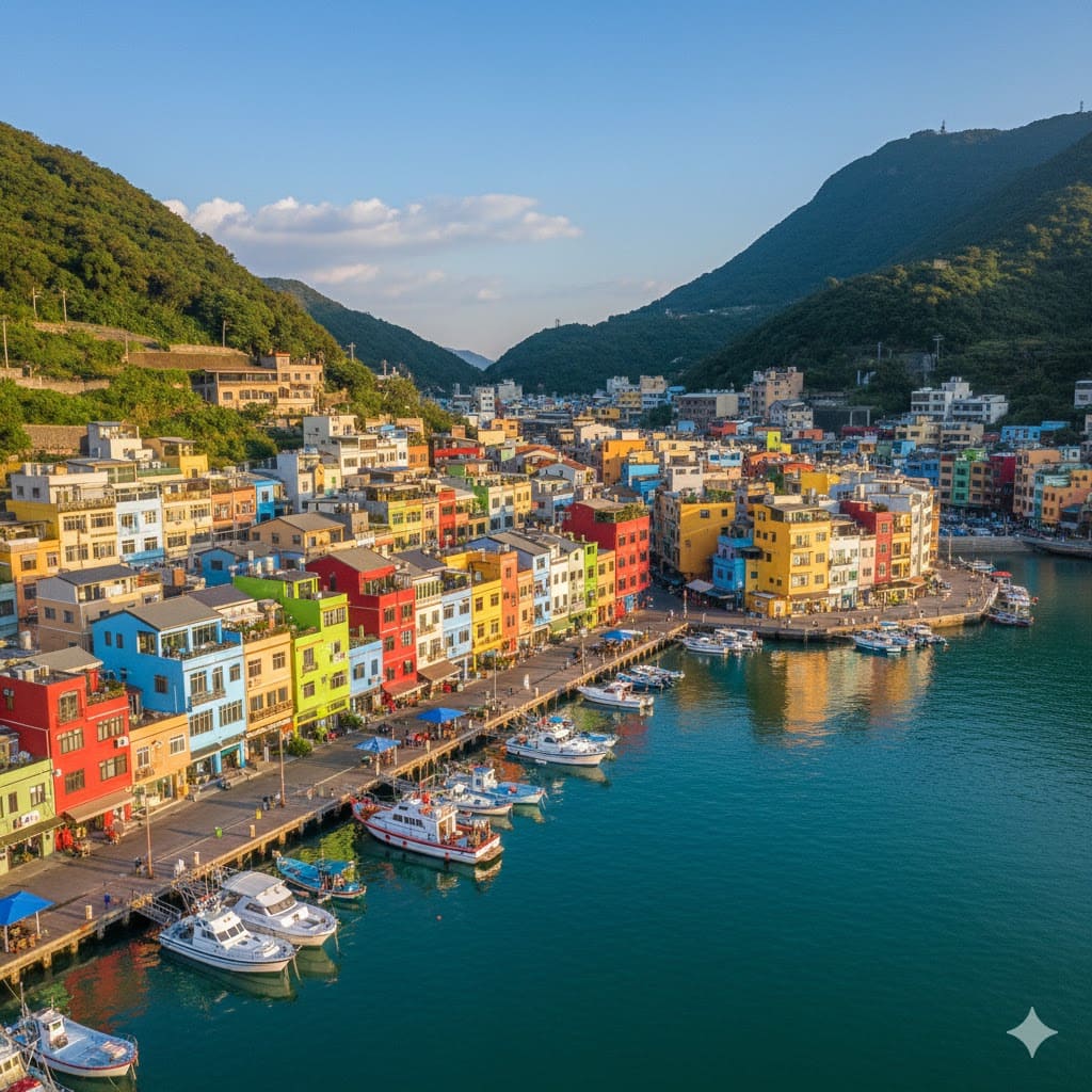
Known as the 'Burano of Kaohsiung'. These colorful buildings near the ferry terminal add a vibrant touch to the harbor view.
Google Map ↗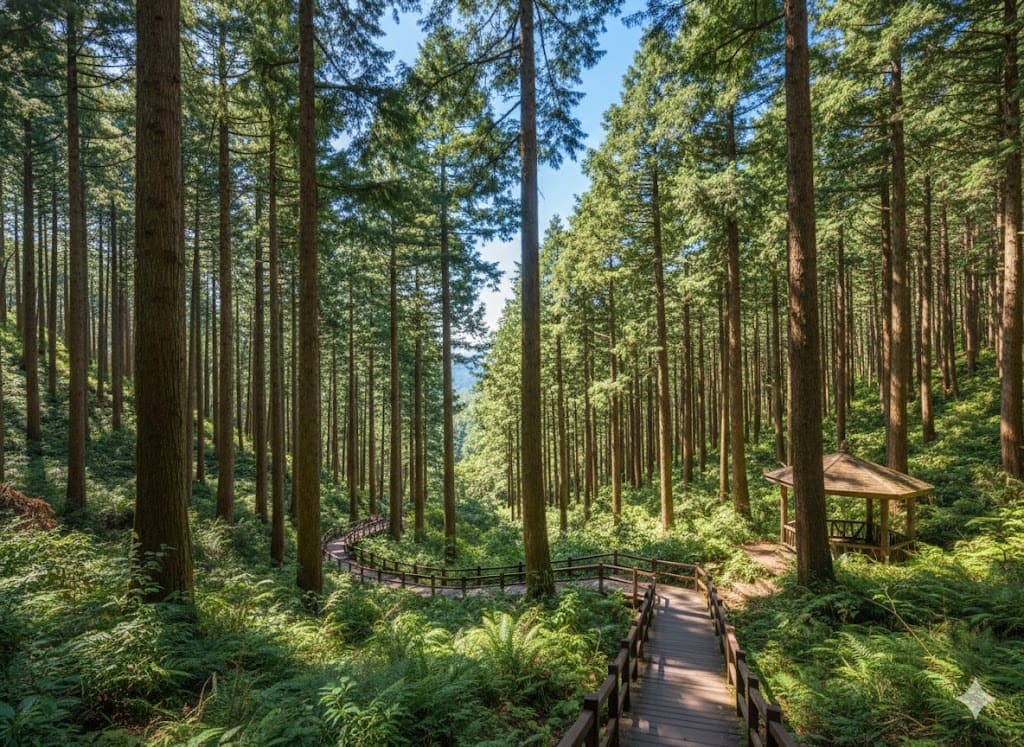
Often called the 'Little Xitou of the South'. This high-altitude forest offers cool temperatures, rich ecology, and healing forest baths.
Google Map ↗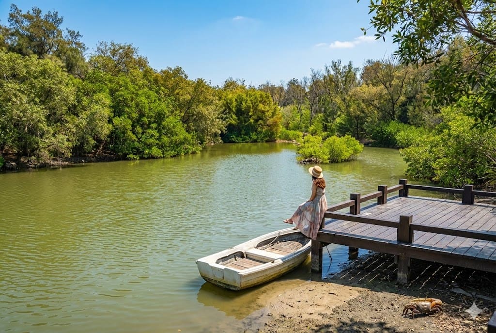
A hidden lake nestled within a casuarina forest near the coast. Its tranquil waters and secluded location make it a secret photography spot.
Google Map ↗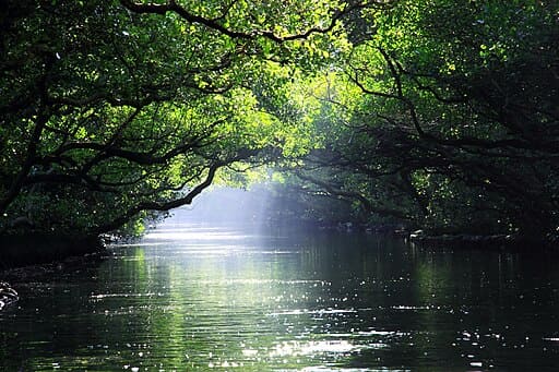
Known as the 'Mini Amazon'. Take a bamboo raft ride through this lush mangrove tunnel where trees form a natural canopy over the water.
Google Map ↗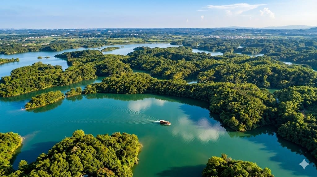
A secluded lake hidden deep in the mountains, accessible only by hiking. Its coral-like shoreline and emerald waters are breathtaking.
Google Map ↗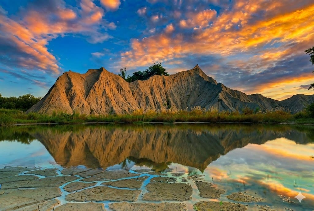
Tainan's own badlands. The chalky soil and barren ridges create a desolate, misty landscape that is especially atmospheric at sunrise.
Google Map ↗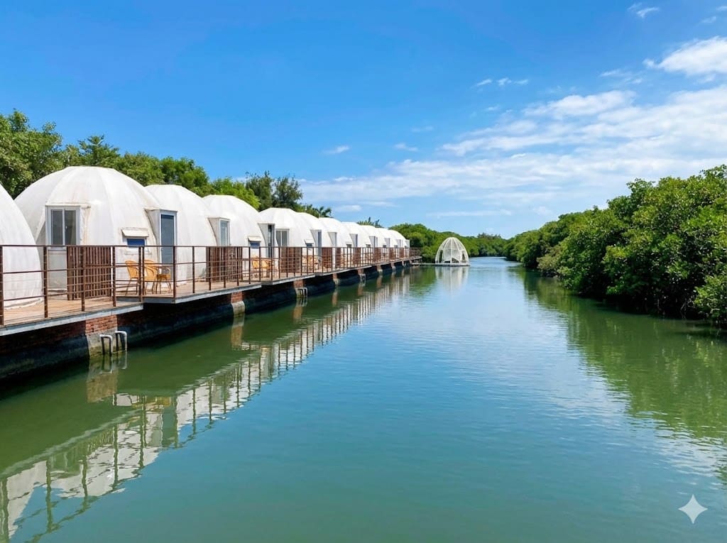
A coastal park featuring a mangrove forest boardwalk and white glamping tents. At night, you can see stars reflecting on the water.
Google Map ↗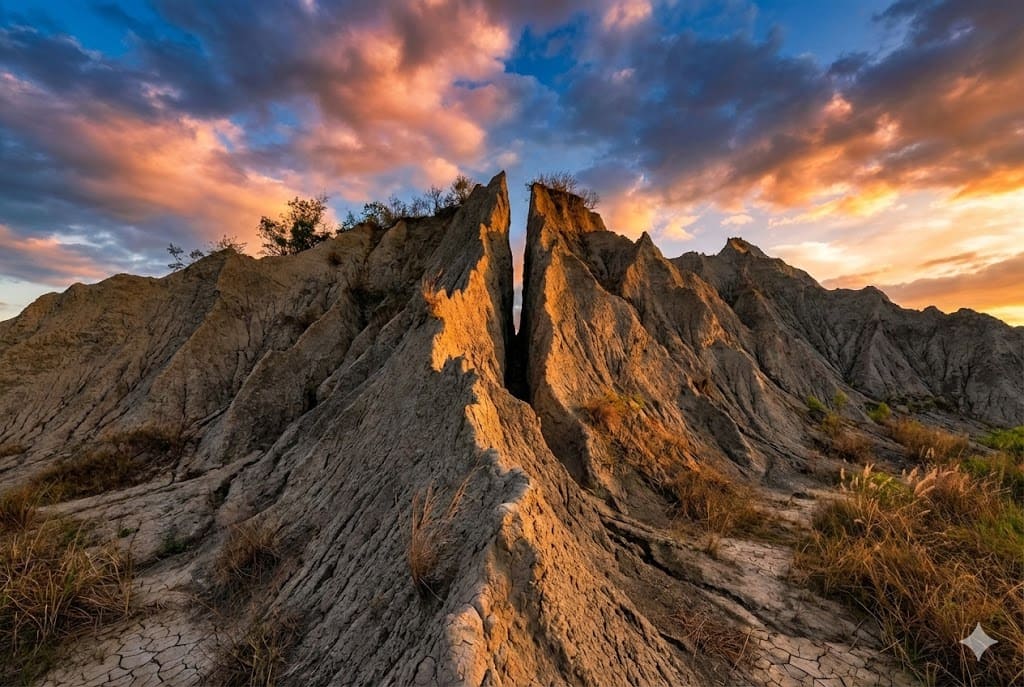
A thrilling hike leading to a massive rock formation resembling a falcon. The 'Thread of Sky' trail here offers dizzying views.
Google Map ↗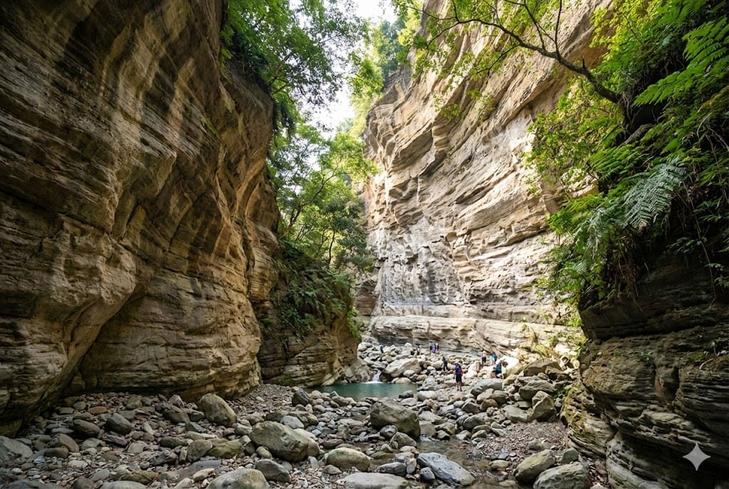
A seasonal wonder accessible only during the dry season. This canyon reveals unique rock textures and a grand landscape usually hidden underwater.
Google Map ↗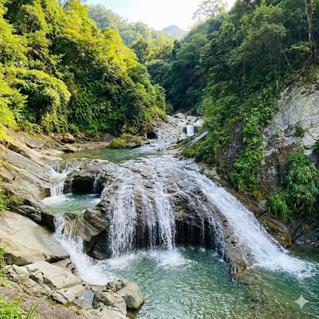
A river tracing paradise famous for its natural rock water slides. The cascading pools and cool waters are perfect for summer adventures.
Google Map ↗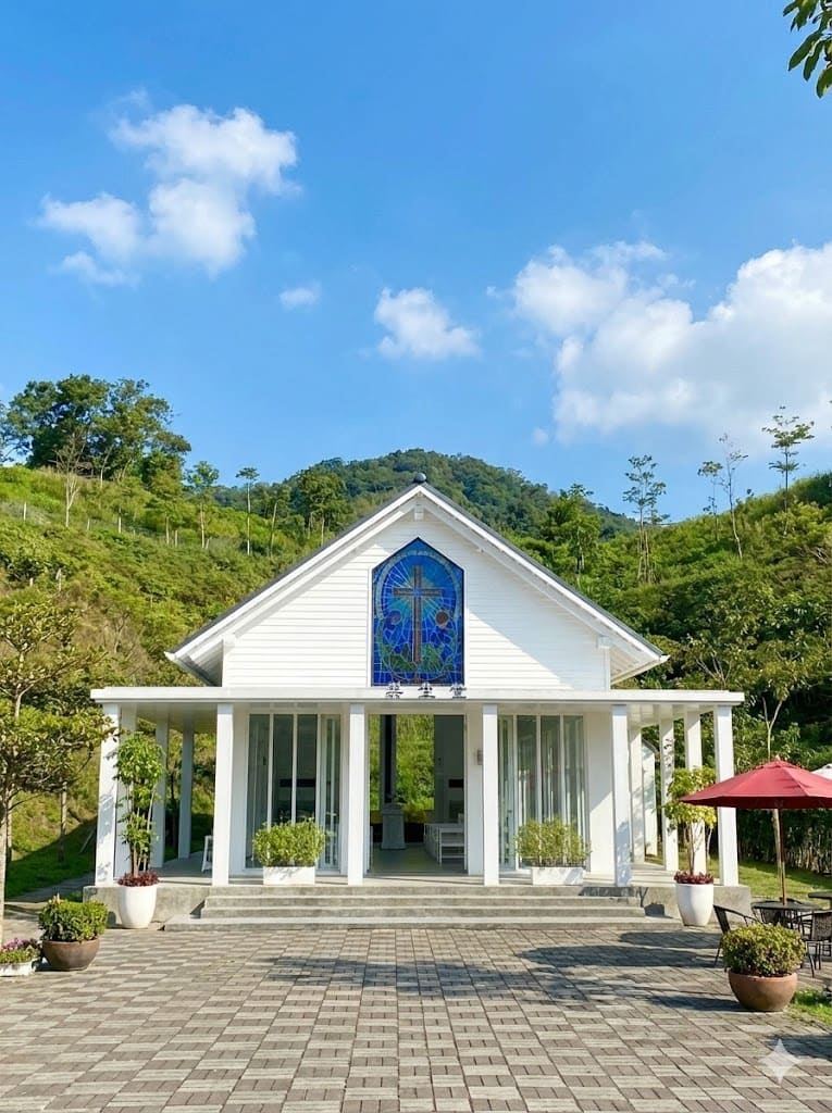
Located in Yintian Mountain House, this pure white church surrounded by greenery is a romantic hidden gem for lovers.
Google Map ↗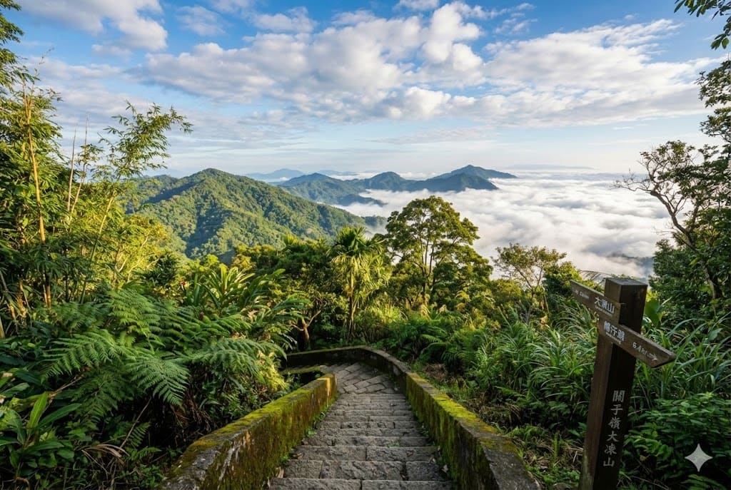
The highest peak in Tainan. A popular hiking trail that offers challenging climbs and rewarding views of the Jianan Plain.
Google Map ↗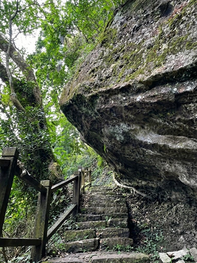
One of Tainan's 'Little Hundred Peaks'. Known for the Lover's Rock and the beautiful views along the Coffee Highway.
Google Map ↗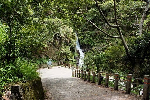
A majestic waterfall that resembles the Bodhisattva Guanyin. Recently reopened, it offers spectacular views and a refreshing mist.
Google Map ↗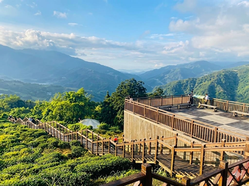
A scenic wooden boardwalk winding through lush tea plantations. It offers panoramic mountain views and is easily accessible.
Google Map ↗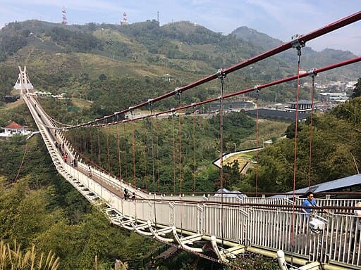
The longest high-altitude suspension bridge in Taiwan. Walking on it feels like walking in the clouds, offering a stunning view of the Chiayi plain.
Google Map ↗
An engineering marvel from 1923 hidden in the forest. This underground weir system uses natural gravity to collect crystal-clear water, creating a sustainable water source that flows year-round.
Google Map ↗
A hidden seven-tiered waterfall located in Manzhou Township. The trail involves some rope climbing, leading to refreshing natural pools perfect for escaping the summer heat.
Google Map ↗
A reconstructed Shinto shrine with a pure white Torii gate standing atop a hill. It offers a breathtaking panoramic view of the mountains meeting the Pacific Ocean.
Google Map ↗
A serene coastline known for its beautiful pebble beaches and the historic Mudan Incident. It's a place where the mountains dramatically meet the sea, perfect for watching the sunrise.
Google Map ↗
A distinct yellow European-style architecture floating on Dapeng Bay. This cafe offers a romantic atmosphere with high ceilings and 360-degree ocean views.
Google Map ↗
The southernmost of Taiwan's 'Five Great Mountains'. Standing at 3,092 meters, it is famous for its majestic sea of clouds, iron hemlock forests, and stunning sunsets.
Google Map ↗
An ancient cross-island trail used since the Qing Dynasty. Rich in biodiversity and history, it connects Pingtung to Taitung through lush forests and misty ridges.
Google Map ↗
Named after the confluence of two streams, this park features a majestic waterfall, stepping-stone trails across rivers, and a rich ecosystem of butterflies and birds.
Google Map ↗
A challenging hike that rewards you with one of the best views in Southern Taiwan. The summit offers a commanding view of the Hengchun Peninsula and the ocean.
Google Map ↗
An easy-to-access trail near the aquarium (NMMBA). The observation deck provides a stunning view of the river mouth entering the ocean and the coastline.
Google Map ↗
The historic site of the Mudan Incident battlefield. The trail involves steep climbs but offers expansive views of the Mudan Reservoir and the surrounding valley.
Google Map ↗
One of Taiwan's last remaining natural coastlines without a highway. The trail features rugged pebble beaches and raw, untouched ocean scenery.
Google Map ↗
A unique botanical garden built on uplifted coral reefs. Explore limestone caves, massive banyan trees, and the iconic Looking Glass Tree.
Google Map ↗
Famous for its limestone terrain and caves. The 'One Line Sky' gorge and the stalactites in the Stone Mother's Milk cave are natural wonders.
Google Map ↗
A unique temple built entirely from seashells, coral, and stones by migrant workers. Its intricate design resembles the work of Gaudí.
Google Map ↗
A surreal badlands landscape that resembles the moon's surface. The rugged terrain and desolate beauty make it a photographer's paradise.
Google Map ↗
A charming fishing port featuring a boardwalk extending into the sea. It's a perfect spot for a leisurely stroll and watching the sunset.
Google Map ↗
Renowned for its majestic mahogany tree avenue that stretches for kilometers. The falling leaves in spring create a romantic, poetic atmosphere.
Google Map ↗
An off-the-beaten-path destination on the historic Aliguan Trail. It offers a glimpse into Taiwan's past and primitive forest landscapes.
Google Map ↗
Known as the 'Burano of Kaohsiung'. These colorful buildings near the ferry terminal add a vibrant touch to the harbor view.
Google Map ↗
Often called the 'Little Xitou of the South'. This high-altitude forest offers cool temperatures, rich ecology, and healing forest baths.
Google Map ↗
A hidden lake nestled within a casuarina forest near the coast. Its tranquil waters and secluded location make it a secret photography spot.
Google Map ↗
Known as the 'Mini Amazon'. Take a bamboo raft ride through this lush mangrove tunnel where trees form a natural canopy over the water.
Google Map ↗
A secluded lake hidden deep in the mountains, accessible only by hiking. Its coral-like shoreline and emerald waters are breathtaking.
Google Map ↗
Tainan's own badlands. The chalky soil and barren ridges create a desolate, misty landscape that is especially atmospheric at sunrise.
Google Map ↗
A coastal park featuring a mangrove forest boardwalk and white glamping tents. At night, you can see stars reflecting on the water.
Google Map ↗
A thrilling hike leading to a massive rock formation resembling a falcon. The 'Thread of Sky' trail here offers dizzying views.
Google Map ↗
A seasonal wonder accessible only during the dry season. This canyon reveals unique rock textures and a grand landscape usually hidden underwater.
Google Map ↗
A river tracing paradise famous for its natural rock water slides. The cascading pools and cool waters are perfect for summer adventures.
Google Map ↗
Located in Yintian Mountain House, this pure white church surrounded by greenery is a romantic hidden gem for lovers.
Google Map ↗
The highest peak in Tainan. A popular hiking trail that offers challenging climbs and rewarding views of the Jianan Plain.
Google Map ↗
One of Tainan's 'Little Hundred Peaks'. Known for the Lover's Rock and the beautiful views along the Coffee Highway.
Google Map ↗
A majestic waterfall that resembles the Bodhisattva Guanyin. Recently reopened, it offers spectacular views and a refreshing mist.
Google Map ↗
A scenic wooden boardwalk winding through lush tea plantations. It offers panoramic mountain views and is easily accessible.
Google Map ↗
The longest high-altitude suspension bridge in Taiwan. Walking on it feels like walking in the clouds, offering a stunning view of the Chiayi plain.
Google Map ↗Breathtaking coastlines, majestic gorges, and indigenous culture.
A natural sea cave formed by erosion that resembles a cat's head. Located on Jinzun Beach, it is a hidden photogenic spot accessible during low tide.
Google Map ↗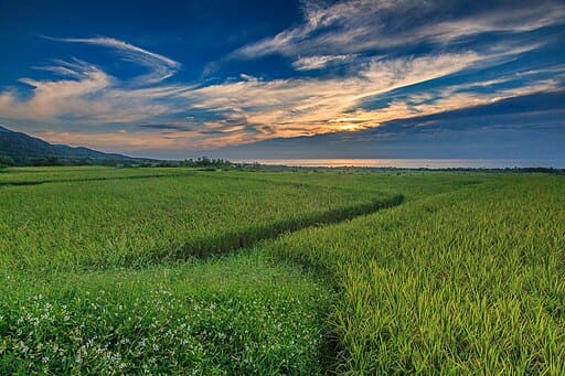
A straight road leading directly toward the Pacific Ocean, with King Kong Mountain in the background. It offers a stunning view where the mountain meets the sea.
Google Map ↗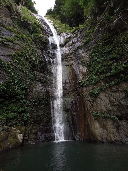
A spectacular waterfall located right by the roadside. The water cascades down a high cliff, making it easily accessible and breathtaking.
Google Map ↗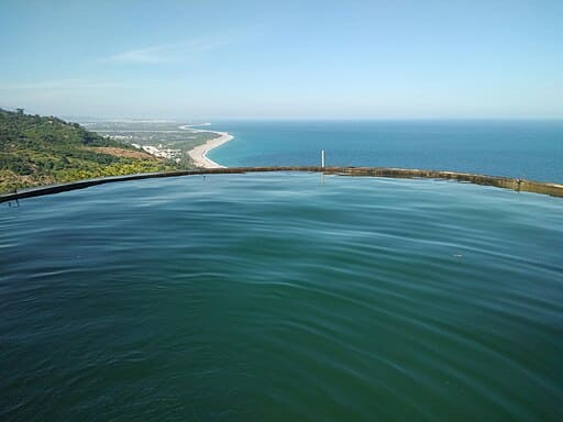
Known for its heart-shaped cove and the 'Sky Mirror' water pool that reflects the blue sky and ocean, offering a mesmerizing view of the coastline.
Google Map ↗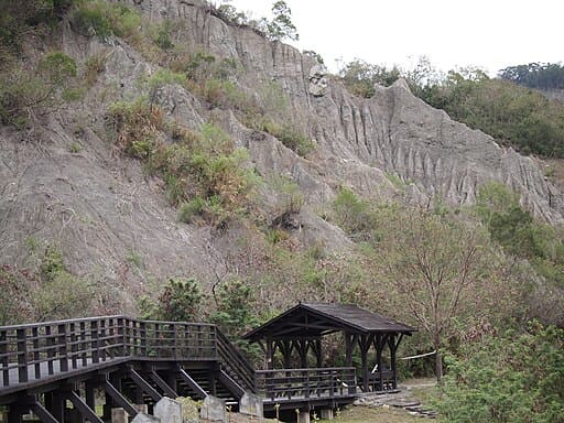
Often called the 'Moon World of Taitung'. The rugged, barren landscape created by plate tectonics creates a surreal, alien atmosphere.
Google Map ↗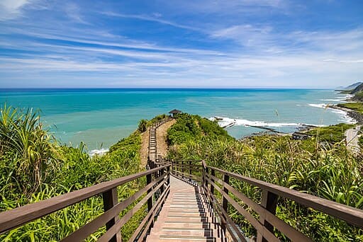
A short wooden trail that takes only 15 minutes to hike. It offers a panoramic 360-degree view of the Pacific coastline and the blue ocean.
Google Map ↗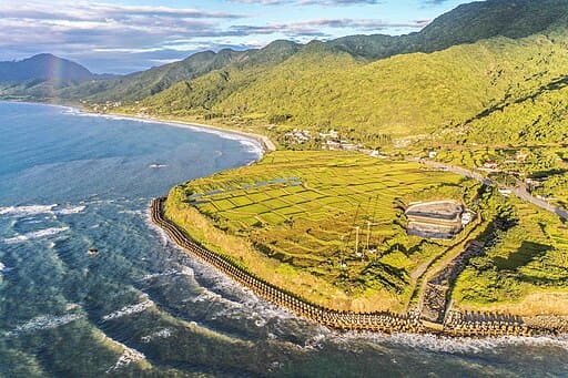
The largest coastal rice terraces in Taiwan. During harvest season, the golden rice fields contrast beautifully with the vast blue Pacific Ocean.
Google Map ↗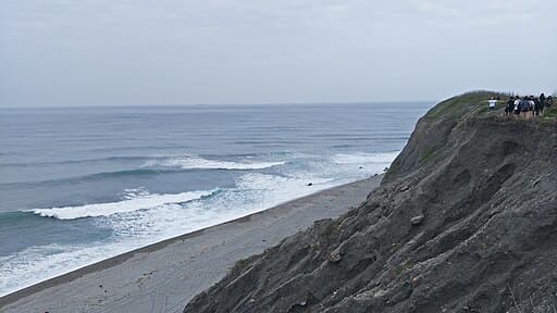
A former military vantage point turned secret spot. It offers the best bird's-eye view of the crescent-shaped Qixingtan Beach.
Google Map ↗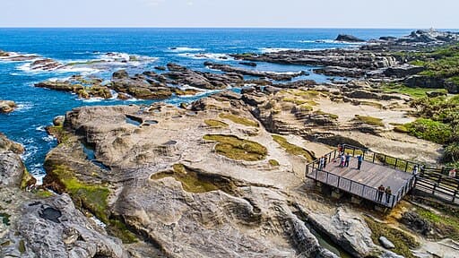
A world-class outdoor geology classroom featuring massive white volcanic rock formations and potholes carved by the sea.
Google Map ↗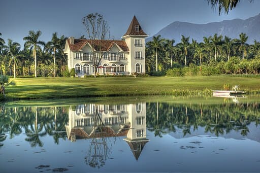
An artificial lake surrounded by bald cypress trees. The reflection of the trees in the turquoise water creates a European fairytale scenery.
Google Map ↗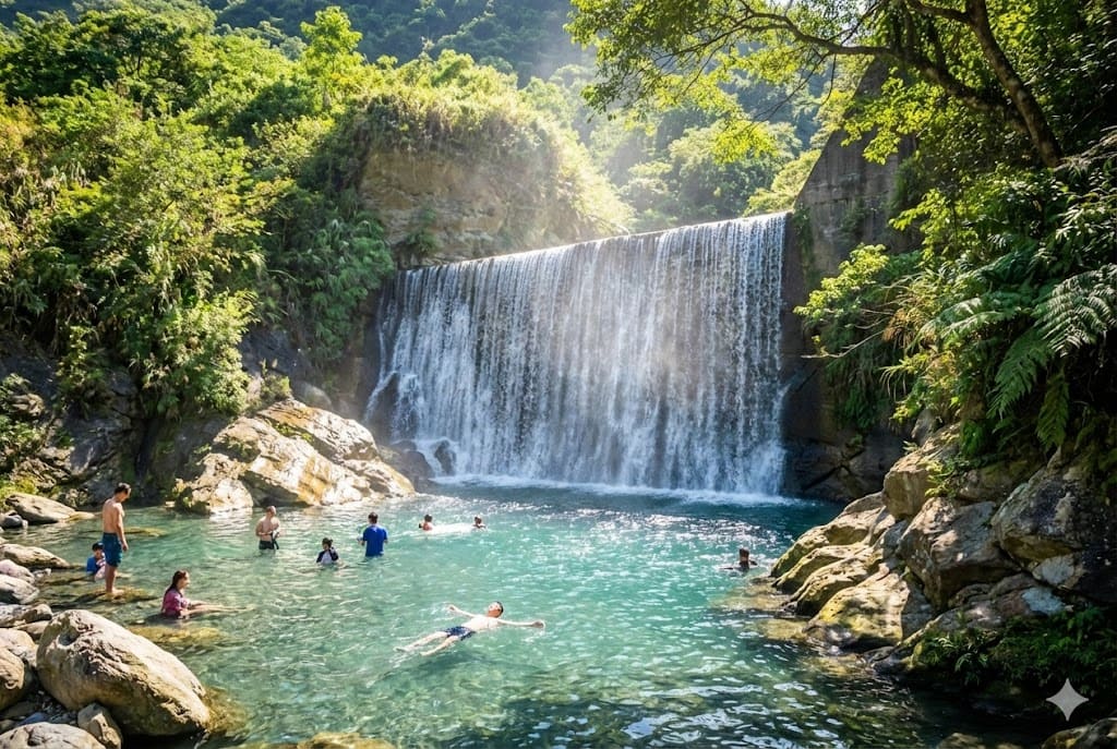
Located near Mugumuyu, this hidden valley features a stunning 'Water Curtain Waterfall' and crystal-clear streams perfect for summer swimming.
Google Map ↗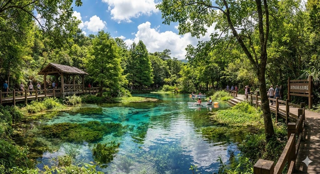
Known as 'Blue Tears of the Land'. The natural spring water is so clear that it appears vibrant blue, surrounded by peaceful nature.
Google Map ↗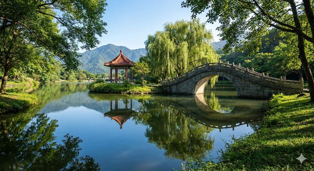
A revitalized timber pond turned ecological park. The arch bridges and pavilions create a serene, Chinese-style garden atmosphere.
Google Map ↗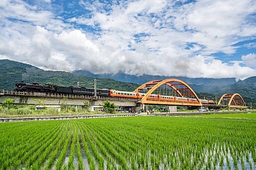
Two red iron bridges set against changing seasonal rice fields and mountains. It is a favorite spot for photographers to capture trains passing by.
Google Map ↗
A natural sea cave formed by erosion that resembles a cat's head. Located on Jinzun Beach, it is a hidden photogenic spot accessible during low tide.
Google Map ↗
A straight road leading directly toward the Pacific Ocean, with King Kong Mountain in the background. It offers a stunning view where the mountain meets the sea.
Google Map ↗
A spectacular waterfall located right by the roadside. The water cascades down a high cliff, making it easily accessible and breathtaking.
Google Map ↗
Known for its heart-shaped cove and the 'Sky Mirror' water pool that reflects the blue sky and ocean, offering a mesmerizing view of the coastline.
Google Map ↗
Often called the 'Moon World of Taitung'. The rugged, barren landscape created by plate tectonics creates a surreal, alien atmosphere.
Google Map ↗
A short wooden trail that takes only 15 minutes to hike. It offers a panoramic 360-degree view of the Pacific coastline and the blue ocean.
Google Map ↗
The largest coastal rice terraces in Taiwan. During harvest season, the golden rice fields contrast beautifully with the vast blue Pacific Ocean.
Google Map ↗
A former military vantage point turned secret spot. It offers the best bird's-eye view of the crescent-shaped Qixingtan Beach.
Google Map ↗
A world-class outdoor geology classroom featuring massive white volcanic rock formations and potholes carved by the sea.
Google Map ↗
An artificial lake surrounded by bald cypress trees. The reflection of the trees in the turquoise water creates a European fairytale scenery.
Google Map ↗
Located near Mugumuyu, this hidden valley features a stunning 'Water Curtain Waterfall' and crystal-clear streams perfect for summer swimming.
Google Map ↗
Known as 'Blue Tears of the Land'. The natural spring water is so clear that it appears vibrant blue, surrounded by peaceful nature.
Google Map ↗
A revitalized timber pond turned ecological park. The arch bridges and pavilions create a serene, Chinese-style garden atmosphere.
Google Map ↗
Two red iron bridges set against changing seasonal rice fields and mountains. It is a favorite spot for photographers to capture trains passing by.
Google Map ↗Pristine beaches, military history, and volcanic wonders.
An impressive wall of basalt columns that resembles a waterfall turned into stone. Located by the sea, it is best viewed at low tide alongside the abandoned fish weirs.
Google Map ↗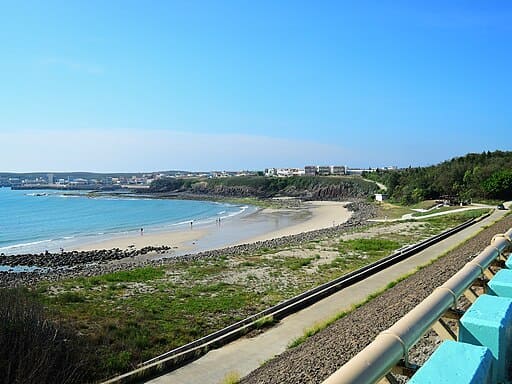
A hidden crescent-shaped beach that only appears during low tide. The water is crystal clear, offering a fleeting moment of beauty before it disappears under the waves.
Google Map ↗
A white bridge stretching into the turquoise ocean towards green pavilions. During high tide, the pavilions appear to float on water, creating a Maldives-like scenery.
Google Map ↗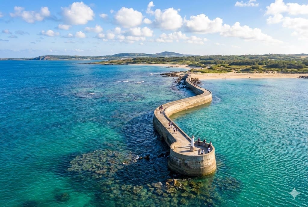
A winding, abandoned pier that snakes out into the azure sea. Walking to the end feels like walking toward the horizon, surrounded by the ocean.
Google Map ↗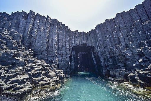
A sea cave on an uninhabited island. When the sun shines from above, the water glows with a mystical electric blue light. Accessible only by boat.
Google Map ↗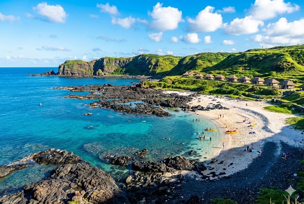
The only white coral beach on Qimei Island. The underwater ecology is rich with coral reefs, making it a prime spot for snorkeling and swimming.
Google Map ↗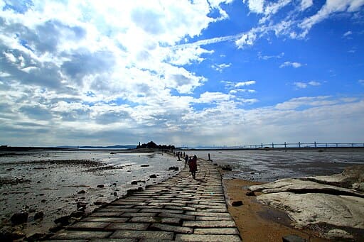
Known as the 'Mont Saint-Michel of Kinmen'. At low tide, a stone path reveals itself, allowing you to walk to the islet past massive 'Oyster Men' statues.
Google Map ↗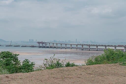
The longest sea-crossing bridge in Taiwan, connecting Greater and Lesser Kinmen. The night view with its colorful LED lights reflecting on the water is stunning.
Google Map ↗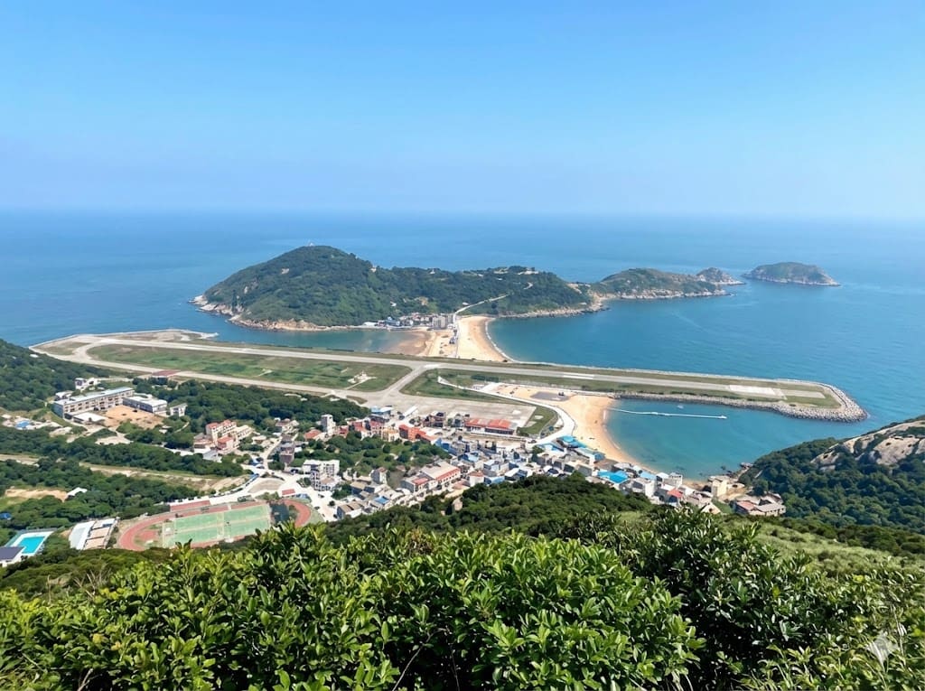
A former military stronghold offering a commanding view of Beigan Airport and the surrounding islands. It features a functional simulation artillery experience.
Google Map ↗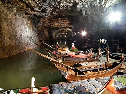
An awe-inspiring underground waterway excavated from granite for military boats. It is now famous for viewing the glowing 'Blue Tears' by canoe in darkness.
Google Map ↗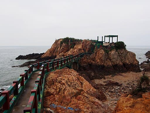
A fortress built on an independent reef, once guarding the coast. You can explore the preserved military dorms, gun emplacements, and tunnels inside the rock.
Google Map ↗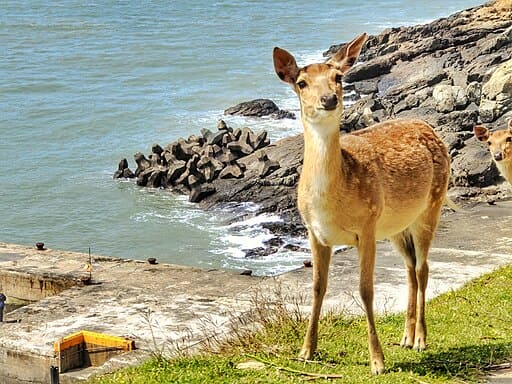
The 'Nara of Matsu'. This uninhabited island is home to hundreds of wild sika deer that roam freely among the abandoned stone houses and coastal trails.
Google Map ↗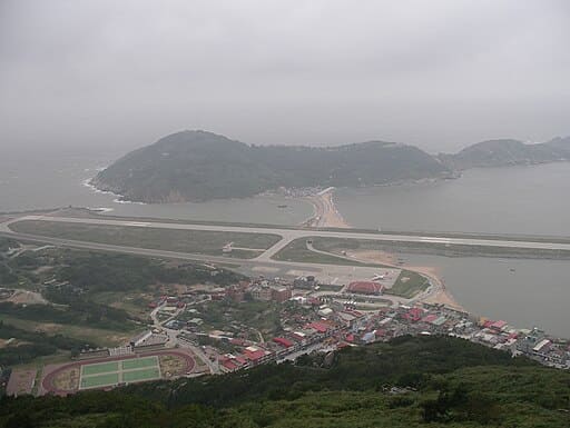
The highest point in Matsu. It offers a breathtaking panoramic view of the airport, sandy beaches, and neighboring islands scattered across the sea.
Google Map ↗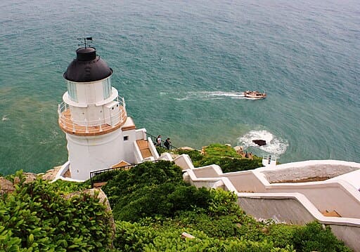
A white British-style lighthouse standing on a steep cliff facing the East China Sea. Built in 1904, it is a national monument and a stunning sunrise spot.
Google Map ↗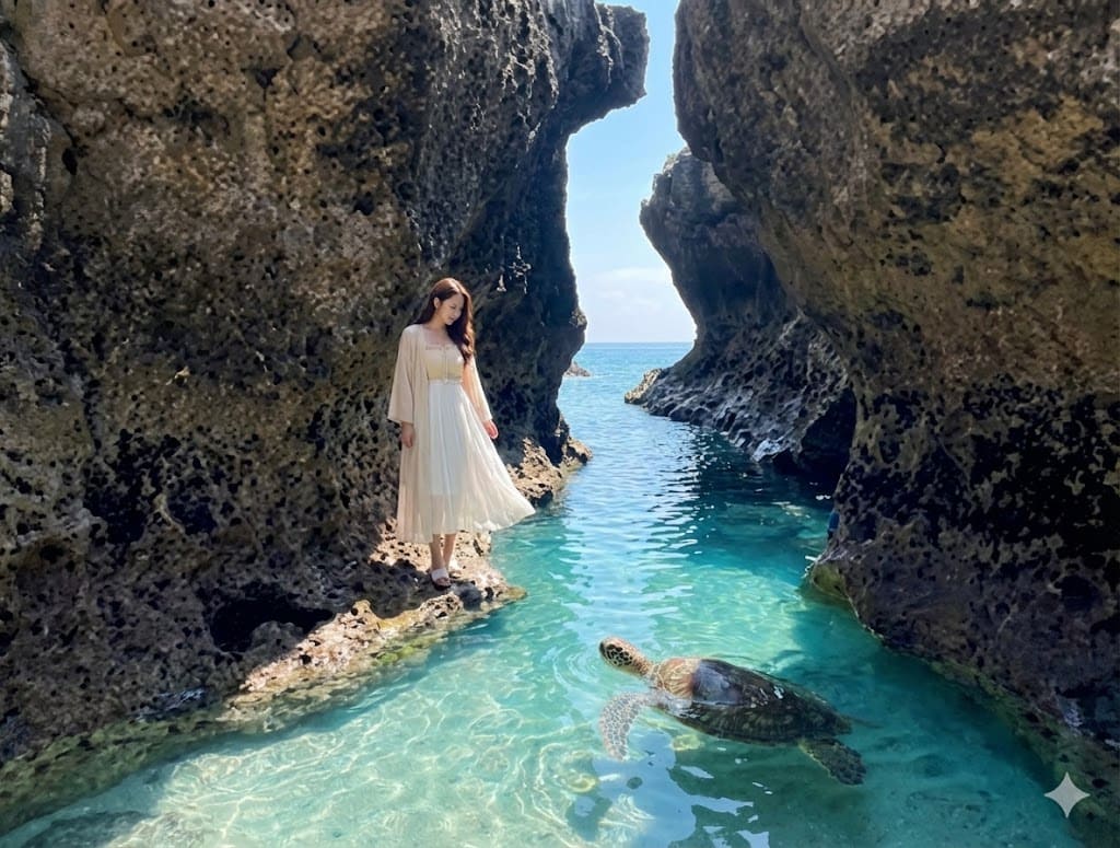
A natural sea cave formed by coral reefs. It features a small sandy beach where you can often spot green sea turtles swimming in the clear channel.
Google Map ↗
A vast intertidal zone on the west side of the island. At sunset, the calm water reflects the sky like a mirror, creating a 'Sky Mirror' effect.
Google Map ↗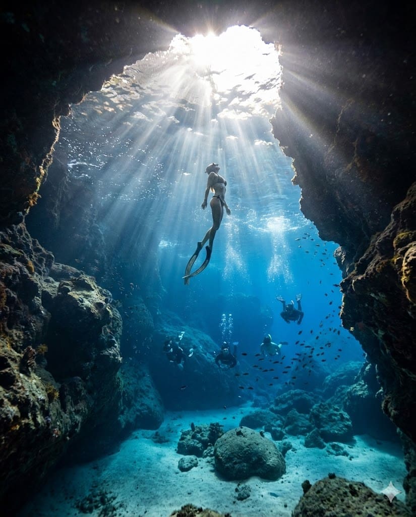
A massive sea cave with deep blue water. Loved by freedivers and photographers for its ethereal light beams and calm natural pool.
Google Map ↗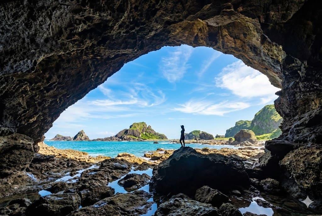
The largest sea arch on Green Island. It frames the blue sky and ocean perfectly, looking like a giant eye gazing at the sea.
Google Map ↗
A pristine white sand beach located near the airport runway. It is often quieter than other beaches and offers incredibly clear water for swimming.
Google Map ↗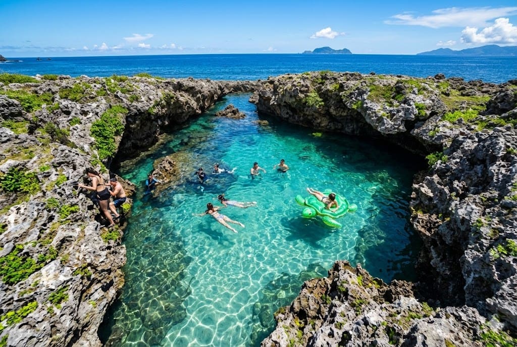
A natural swimming hole formed by coral reefs. The calm, enclosed water is perfect for a relaxing dip while watching the waves crash outside.
Google Map ↗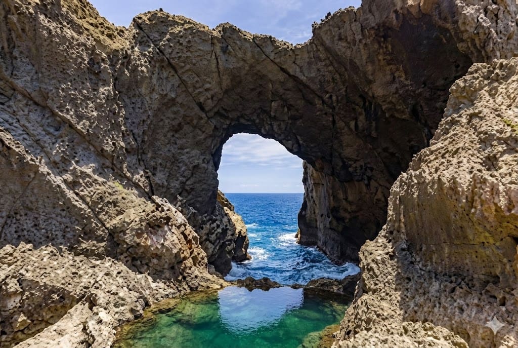
A majestic natural sea arch eroded by waves. The sound of the crashing waves echoes thunderously, and it is a prime spot for watching the sunrise.
Google Map ↗
A massive, dark cave near the coast. It is a place of mystery and local legends, named after the swallows that nest in the rock crevices.
Google Map ↗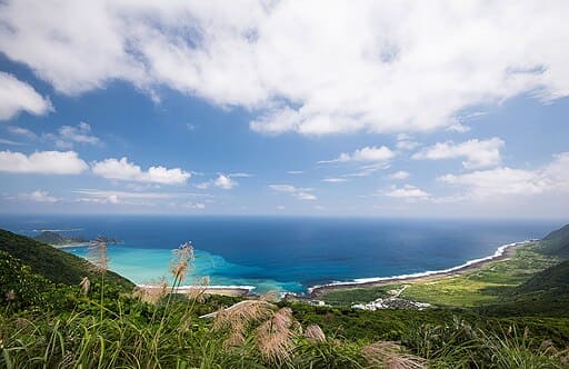
The highest point on Orchid Island. The white building against the blue sky and green mountains offers the best 360-degree view of the entire island.
Google Map ↗
An impressive wall of basalt columns that resembles a waterfall turned into stone. Located by the sea, it is best viewed at low tide alongside the abandoned fish weirs.
Google Map ↗
A hidden crescent-shaped beach that only appears during low tide. The water is crystal clear, offering a fleeting moment of beauty before it disappears under the waves.
Google Map ↗
A white bridge stretching into the turquoise ocean towards green pavilions. During high tide, the pavilions appear to float on water, creating a Maldives-like scenery.
Google Map ↗
A winding, abandoned pier that snakes out into the azure sea. Walking to the end feels like walking toward the horizon, surrounded by the ocean.
Google Map ↗
A sea cave on an uninhabited island. When the sun shines from above, the water glows with a mystical electric blue light. Accessible only by boat.
Google Map ↗
The only white coral beach on Qimei Island. The underwater ecology is rich with coral reefs, making it a prime spot for snorkeling and swimming.
Google Map ↗
Known as the 'Mont Saint-Michel of Kinmen'. At low tide, a stone path reveals itself, allowing you to walk to the islet past massive 'Oyster Men' statues.
Google Map ↗
The longest sea-crossing bridge in Taiwan, connecting Greater and Lesser Kinmen. The night view with its colorful LED lights reflecting on the water is stunning.
Google Map ↗
A former military stronghold offering a commanding view of Beigan Airport and the surrounding islands. It features a functional simulation artillery experience.
Google Map ↗
An awe-inspiring underground waterway excavated from granite for military boats. It is now famous for viewing the glowing 'Blue Tears' by canoe in darkness.
Google Map ↗
A fortress built on an independent reef, once guarding the coast. You can explore the preserved military dorms, gun emplacements, and tunnels inside the rock.
Google Map ↗
The 'Nara of Matsu'. This uninhabited island is home to hundreds of wild sika deer that roam freely among the abandoned stone houses and coastal trails.
Google Map ↗
The highest point in Matsu. It offers a breathtaking panoramic view of the airport, sandy beaches, and neighboring islands scattered across the sea.
Google Map ↗
A white British-style lighthouse standing on a steep cliff facing the East China Sea. Built in 1904, it is a national monument and a stunning sunrise spot.
Google Map ↗
A natural sea cave formed by coral reefs. It features a small sandy beach where you can often spot green sea turtles swimming in the clear channel.
Google Map ↗
A vast intertidal zone on the west side of the island. At sunset, the calm water reflects the sky like a mirror, creating a 'Sky Mirror' effect.
Google Map ↗
A massive sea cave with deep blue water. Loved by freedivers and photographers for its ethereal light beams and calm natural pool.
Google Map ↗
The largest sea arch on Green Island. It frames the blue sky and ocean perfectly, looking like a giant eye gazing at the sea.
Google Map ↗
A pristine white sand beach located near the airport runway. It is often quieter than other beaches and offers incredibly clear water for swimming.
Google Map ↗
A natural swimming hole formed by coral reefs. The calm, enclosed water is perfect for a relaxing dip while watching the waves crash outside.
Google Map ↗
A majestic natural sea arch eroded by waves. The sound of the crashing waves echoes thunderously, and it is a prime spot for watching the sunrise.
Google Map ↗
A massive, dark cave near the coast. It is a place of mystery and local legends, named after the swallows that nest in the rock crevices.
Google Map ↗
The highest point on Orchid Island. The white building against the blue sky and green mountains offers the best 360-degree view of the entire island.
Google Map ↗I recently discovered a beautiful linguistic harmony: "Taiwanese Flavor" (台灣味) is pronounced Táiwān wèi in Mandarin, Tâi-uân-bī in Taiwanese Hokkien, and toiˇ vanˇ mi in Hakka. These remarkably similar sounds across languages inspired the name yourTAIWANME.
Tracing the roots further, the name "Taiwan" itself originates from the Siraya indigenous term Taywan. Early Siraya people referred to the sandbars near the Taijiang Inner Sea as Teyoan or Taioan, meaning "the place where strangers or foreigners live."
To me, yourTAIWANME embodies this fascinating cultural tapestry—a dialogue between the diverse ethnic groups and histories that define our island.
It started with a moment of realization. While hosting international students, I watched them queue endlessly for commercialized "hotspots" and trendy shops. As a local, I found myself unable to share the deeper, authentic stories of my own land.
It wasn't until a general education class, where a classmate vividly described the very alleys I cycled through every day—my rental place, the campus corners—that it hit me: Taiwan isn't mundane; we've simply lost the energy to explore it amidst our busy lives.
Our mission is simple: The Real Taste of Taiwan.
You won't find cliché tourist traps here. Instead, we guide you to the authentic scenery hidden in ordinary alleys—stories worth telling. Whether you are a first-time traveler or a long-time resident, we hope to accompany you in finding that unique, irreplaceable Taiwanese sentiment.
Many visit Taiwan, but few truly see it.
yourTAIWANME was created to unveil the island’s best-kept secrets. Whether it's the profound indigenous culture of Pingtung or the mystical Water Lantern ceremonies in Keelung, we exist to help you find the real taste of Taiwan.
But our vision goes deeper than just tourism. We aim to not only offer foreign travelers a genuine opportunity to deeply understand Taiwan, but also to inspire locals to rediscover the beauty of the land they call home. We believe every corner of this island has a story waiting to be told—and heard.
To be completely honest with you—we are just getting started. We are a young platform, and we know we have a long way to go. We believe that trust and reputation are earned over time, not overnight. Right now, our primary focus is on pouring our hearts into creating the best content possible, rather than seeking commercial spotlight or formal advertising partnerships. We want to make sure we are truly providing value before we ask for your investment.
That said, we never say no to a good conversation. If our mission resonates with you, or if you see the potential in what we are building—even while we are still in our early days—we would be honored to hear from you. Whether you have a suggestion, a story to share, or simply want to support a growing team, please feel free to reach out.
| Coin | Network | Address |
|---|---|---|
| BTC | Bitcoin |
393SydmjKD8fKYSaiFhZYvxPNi4rgSyzGA
|
| ETH | ERC20 |
0x7563Fa328f07373cb8F458EefDcc5e9FFF657D3C
|
| BNB | BSC (BEP20) |
0x7563Fa328f07373cb8F458EefDcc5e9FFF657D3C
|
| BNB | ERC20 |
0x7563Fa328f07373cb8F458EefDcc5e9FFF657D3C
|
| USDT | BSC (BEP20) |
0x7563Fa328f07373cb8F458EefDcc5e9FFF657D3C
|
| USDT | ERC20 |
0x7563Fa328f07373cb8F458EefDcc5e9FFF657D3C
|
| USDC | BSC (BEP20) |
0x7563Fa328f07373cb8F458EefDcc5e9FFF657D3C
|
| USDC | ERC20 |
0x7563Fa328f07373cb8F458EefDcc5e9FFF657D3C
|
| BCH | Bitcoin Cash |
qprnfkc6x5k2zc5wrfv0x78zv34dvs7nlswhfmzep0
|
Coming Soon...